| A39 | ||||
|---|---|---|---|---|
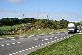
 Looking north near Carland Cross in Cornwall | ||||
| Route information | ||||
| Length | 191 mi (307 km) | |||
| Major junctions | ||||
| North East end | at Bath 51°23′10″N 2°25′51″W / 51.3861°N 2.4307°W | |||
| ||||
| South West end | Falmouth 50°08′58″N 5°03′26″W / 50.1495°N 5.0573°W | |||
| Location | ||||
| Country | United Kingdom | |||
| Primary destinations | Truro Wadebridge Bude Bideford Barnstaple Minehead Bridgwater Glastonbury | |||
| Road network | ||||
| ||||
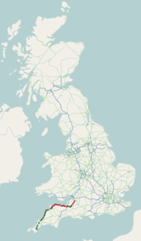
The A39 is an A road in south west England. It runs south-west from Bath in Somerset through Wells, Glastonbury, Street and Bridgwater. It then follows the north coast of Somerset, Devon and Cornwall through Williton, Minehead, Porlock, Lynmouth, Barnstaple, Bideford, Stratton, Camelford, Wadebridge and St Columb Major. It then joins the route of the A30 road for around 5 miles (8.0 km), re-emerging near Zelah to head for the south Cornish coast via Truro and Falmouth.
In Cornwall and North Devon (until the junction with the A361 "North Devon Link Road"), the road is known as the Atlantic Highway, and was classified as a trunk road until 2002.


