Road in England
|
A41 |
|---|
|
 |
|
| Maintained by |
| Length | 155.2 mi[1][2][3] (249.8 km) |
|---|
| Existed | 1922–present |
|---|
|
| Southeast end |  A40 in Westminster, London A40 in Westminster, London |
|---|
| Major intersections |  A1 in Barnet, London A1 in Barnet, London
 M1 near Elstree M1 near Elstree
 M25 near Abbots Langley M25 near Abbots Langley
  M40 / A34 near Bicester M40 / A34 near Bicester
  M42 / A4141 near Solihull M42 / A4141 near Solihull
 M5 in West Bromwich M5 in West Bromwich
 M54 near Tong M54 near Tong
 M53 near Hooton M53 near Hooton |
|---|
| Northwest end |    A57 / A59 / A5038 in Liverpool A57 / A59 / A5038 in Liverpool |
|---|
|
|
|---|
|
| Country | United Kingdom |
|---|
| Counties | Greater London, Hertfordshire, Buckinghamshire, Oxfordshire, West Midlands, Staffordshire, Shropshire, Cheshire, Merseyside |
|---|
Primary
destinations | London
West End
Brent Cross
Edgware
Watford
Hemel Hempstead
Aylesbury
Bicester
Solihull
Birmingham
West Bromwich
Wolverhampton
Whitchurch
Chester
Ellesmere Port
Birkenhead |
|---|
|
|
|---|
|
|
|
|
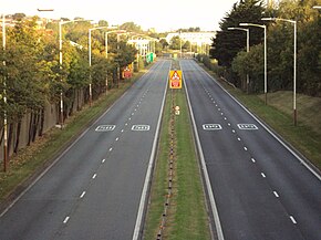
The A41 is a trunk road between London and Liverpool, England. Now in parts replaced by motorways, it passes through or near Watford, Kings Langley, Hemel Hempstead, Aylesbury, Bicester, Solihull, Birmingham, West Bromwich, Wolverhampton, Newport, Whitchurch, Chester and Ellesmere Port.
With the opening of the M40 extension in 1990 from junction 8, much of the route was downgraded. The sections between Bicester and the M42 near Solihull in the Midlands have been re-classified B4100, A4177 and A4141.
- ^ Cite error: The named reference
Seg1 was invoked but never defined (see the help page).
- ^ Cite error: The named reference
Seg2 was invoked but never defined (see the help page).
- ^ Cite error: The named reference
Seg3 was invoked but never defined (see the help page).


