Back جبال لبنان الشرقية Arabic جبال لبنان الشرقيه ARZ Anti-Livan dağları Azerbaijani Антыліван Byelorussian Антиливан Bulgarian পূর্ব পর্বতমালা, লেবানন Bengali/Bangla Antilíban Catalan Anti-Lebanon CEB کێوەکانی لوبنان CKB Antilibanon Czech
This article needs additional citations for verification. (December 2009) |
| Anti-Lebanon mountains | |
|---|---|
| جبال لبنان الشرقية | |
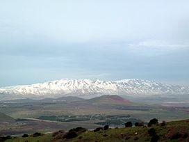
 Mount Hermon, highest point in the Anti-Lebanon range, looking north from Mount Bental | |
| Highest point | |
| Peak | Mount Hermon |
| Elevation | 2,814 m (9,232 ft) |
| Dimensions | |
| Length | 150 km (93 mi) |
| Geography | |
 Satellite image of Lebanon. The snow-covered areas nearer the coast are the Mount Lebanon range and the snow-covered areas further inland are the Anti-Lebanon mountain range.
| |
| Location | Syria, Lebanon, Golan Heights (occupied by Israel) |
| Range coordinates | 34°00′N 36°30′E / 34°N 36.5°E |
The Anti-Lebanon mountains (Arabic: جبال لبنان الشرقية, romanized: Jibāl Lubnān ash-Sharqiyyah, lit. 'eastern mountains of Lebanon') are a southwest–northeast-trending, c. 150 kilometres (93 miles) long mountain range that forms most of the border between Syria and Lebanon. The border is largely defined along the crest of the range. Most of the range lies in Syria.