Back مطار باجدوجرا Arabic Aeropuertu de Bagdogra AST বাগডোগরা বিমানবন্দর Bengali/Bangla Bagdogra Airport CEB Flughafen Bagdogra German Aeropuerto de Bagdogra Spanish فرودگاه باگدوگرا Persian Aéroport de Bagdogra French Aeroporto de Bagdogra Galician बागडोगरा विमानक्षेत्र Hindi
Parts of this article (those related to Air Force Station) need to be updated. (January 2024) |
Bagdogra Airport | |||||||||||
|---|---|---|---|---|---|---|---|---|---|---|---|
 | |||||||||||
| Summary | |||||||||||
| Airport type | Military/Public | ||||||||||
| Owner | Indian Air Force | ||||||||||
| Operator | Airports Authority of India | ||||||||||
| Serves | Siliguri | ||||||||||
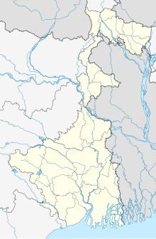
| Location | Bagdogra, Siliguri, West Bengal, India | ||||||||||
| Hub for | |||||||||||
| Elevation AMSL | 126 m / 412 ft | ||||||||||
| Coordinates | 26°40′52″N 088°19′43″E / 26.68111°N 88.32861°E | ||||||||||
| Map | |||||||||||
| Runways | |||||||||||
| |||||||||||
| Statistics (April 2023 - March 2024) | |||||||||||
| |||||||||||

Bagdogra Airport (IATA: IXB, ICAO: VEBD) is a customs airport serving the city of Siliguri in West Bengal, India. It is located in Bagdogra, 12 km (7.5 mi) south-west from the city centre.[4] It is operated as a civil enclave at Bagdogra Air Force Station of the Indian Air Force. It is the gateway to the hill stations of Darjeeling, Gangtok, Kurseong, Kalimpong, Mirik and other parts of North Bengal region. Siliguri, being a major transport and economic hub, the airport sees thousands of travellers and tourists annually. The Government of India conferred limited international airport status to the airport in 2002 with limited international operations to Bangkok–Suvarnabhumi and Paro. This is the second busiest airport in West Bengal.
The airport experiences humid subtropical climate (Köppen Climate Classification code: Cwa) - hot humid summers and cool winters. There is significant precipitation in all seasons, but remains drier in winters.[5][6] Air traffic at Bagdogra crossed 1 million for the first time, growing at 43.6% percent in 2014–15. In 2019–20, the airport served 3.2 million passengers, which was an increase of 11.2% from the previous year, making it the 17th-busiest airport in India. It is one of the few airports in India with zero sales tax on aviation turbine fuel.[7]
- ^ "Annexure III – Passenger Data" (PDF). aai.aero. Retrieved 22 April 2024.
- ^ "Annexure II – Aircraft Movement Data" (PDF). aai.aero. Retrieved 22 April 2024.
- ^ "Annexure IV – Freight Movement Data" (PDF). aai.aero. Retrieved 22 April 2024.
- ^ "Airports Authority of India". Archived from the original on 22 December 2015. Retrieved 2 January 2016.
- ^ Cite error: The named reference
TOI1was invoked but never defined (see the help page). - ^ "International status to Bagdogra airport hailed". The Times of India. 2 October 2002. Retrieved 15 July 2014.
- ^ "Bagdogra backs CM flight path- Tax waiver fuels air traffic growth". The Telegraph (Calcutta). Archived from the original on 28 July 2015. Retrieved 27 July 2015.

