Back محافظة باريسال Arabic Barisal (əyalət, Banqladeş) Azerbaijani Барисал (област) Bulgarian বরিশাল বিভাগ Bengali/Bangla বরিশাল বিভাগ BPY Divisió de Barisal Catalan Barisal Division CEB Barishal (Division) German Διαίρεση Μπαρισάλ Greek Barizalo (regiono) Esperanto
Barisal Division
বরিশাল বিভাগ Bakla-Chandradwip | |
|---|---|
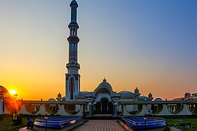
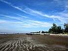
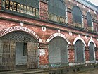
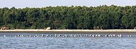
Clockwise from the top: Baitul Aman Mosque, Brojomohun College, Kuakata Beach, Kirtipasha Zamindar House in Jhalokathi, Floating Stall at Kirtankhola in Nesarabad, and Edges of Sundarbans in Barguna | |
| Nickname: Veneto of East | |
| Coordinates: 22°30′N 90°20′E / 22.500°N 90.333°E | |
| Country | |
| Established | 1 January 1993 |
| Capital and largest city | Barisal |
| Government | |
| • Divisional Commissioner | Md. Showkat Ali[1] |
| • Parliamentary constituency | Jatiya Sangsad (21 seats) |
| Area | |
| • Total | 13,225.20 km2 (5,106.28 sq mi) |
| Elevation | 1.2 m (3.9 ft) |
| Population (2011 census) | |
| • Total | 9,100,102 |
| • Density | 690/km2 (1,800/sq mi) |
| Demonyms | Barisali, Borishali, Borishailla |
| Time zone | UTC+6 (BST) |
| ISO 3166 code | BD-A |
| HDI (2018) | 0.629[2] medium |
| Notable cricket teams | Fortune Barishal, Barisal Division |
| Districts | 6 |
| Sub-Districts | 41 |
| Union Councils | 352 |
| Website | barisaldiv |
Barisal Division is one of the eight administrative divisions of Bangladesh. Located in the south-central part of the country, it has an area of 13,644.85 km2 (5,268.31 sq mi), and a population of 9,100,102 at the 2011 Census. It is the least populous Division in Bangladesh. It is bounded by Dhaka Division on the north, the Bay of Bengal on the south, Chittagong Division on the east and Khulna Division on the west. The administrative capital, Barisal city, lies in the Padma River delta on an offshoot of the Arial Khan River. Barisal division is criss-crossed by numerous rivers that earned it the nickname Dhan-Nodi-Khal, Ei tin-e Borishal (rice, river and canal built Barisal).
- ^ "List of Divisional Commissioners". Archived from the original on 2022-06-18. Retrieved 2022-06-20.
- ^ "Sub-national HDI - Area Database - Global Data Lab". hdi.globaldatalab.org. Retrieved 2021-07-08.


