Back بيتسفيل Arabic بيتسفيل ARZ بتسویل (آرکانزاس) AZB Batesville (Arkansas) Catalan Бейтсвилл (Арканзас) CE Batesville (kapital sa kondado) CEB Batesville, Arkansas Welsh Batesville (Arkansas) German Batesville (Arkansas) Spanish Batesville (Arkansas) Basque
Batesville, Arkansas | |
|---|---|
 Josephine Street in the fall | |
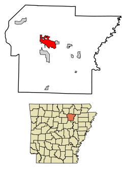
 Location of Batesville in Independence County, Arkansas. | |
| Coordinates: 35°46′25″N 91°38′29″W / 35.77361°N 91.64139°W | |
| Country | United States |
| State | Arkansas |
| County | Independence |
| Founded | 1821 |
| Incorporated | 1822 |
| Government | |
| • Mayor | Rick Elumbaugh (D) |
| Area | |
| • Total | 11.71 sq mi (30.33 km2) |
| • Land | 11.60 sq mi (30.03 km2) |
| • Water | 0.11 sq mi (0.30 km2) |
| Elevation | 377 ft (115 m) |
| Population (2020) | |
| • Total | 11,191 |
| • Density | 965.16/sq mi (372.64/km2) |
| Time zone | UTC-6 (CST) |
| • Summer (DST) | UTC-5 (CDT) |
| ZIP codes | 72501, 72503 |
| Area code | 870 |
| FIPS code | 05-04030 |
| GNIS feature ID | 2403819[2] |
| Website | Official Website for the City of Batesville, Arkansas |
Batesville is the county seat and largest city of Independence County, Arkansas, United States,[3] 80 miles (183 km) northeast of Little Rock, the state capital. According to the 2010 Census, the population of the city was 10,268.[4] The city serves as a regional manufacturing and distribution hub for the Ozark Mountain region and Northeast Arkansas.

- ^ "2020 U.S. Gazetteer Files". United States Census Bureau. Retrieved October 29, 2021.
- ^ a b U.S. Geological Survey Geographic Names Information System: Batesville, Arkansas
- ^ "Find a County". National Association of Counties. Archived from the original on July 12, 2012. Retrieved June 7, 2011.
- ^ "U.S. Census Bureau Delivers Arkansas' 2010 Census Population Totals, Including First Look at Race and Hispanic Origin Data for Legislative Redistricting". 2010 Census. U.S. Census Bureau, Population Division. February 10, 2011. Archived from the original on May 23, 2012. Retrieved May 28, 2012.