Back Parramatta (rehiyon sa Ostralya) CEB Parramatta City German Ville de Parramatta French Kota Parramatta ID Città di Parramatta Italian シティ・オブ・パラマッタ Japanese Parramatta (LGA) Dutch City of Parramatta Polish Cidade de Parramatta Portuguese City of Parramatta Swedish
| City of Parramatta New South Wales | |||||||||||||||
|---|---|---|---|---|---|---|---|---|---|---|---|---|---|---|---|
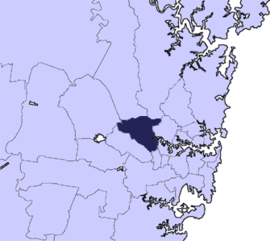
 Located in Metropolitan Sydney | |||||||||||||||
| Coordinates | 33°49′S 151°00′E / 33.817°S 151.000°E | ||||||||||||||
| Population | 256,729 (2021 census)[1] (12th) | ||||||||||||||
| • Density | 3,056/km2 (7,920/sq mi) | ||||||||||||||
| Established | 27 November 1861 (Municipality) 27 October 1938 (City) | ||||||||||||||
| Postcode(s) | 2153, 2152, 2151, 2150, 2147, 2146, 2145, 2142, 2141, 2128, 2127, 2122, 2121, 2119, 2118, 2117, 2116, 2115, 2114 | ||||||||||||||
| Area | 84 km2 (32.4 sq mi) | ||||||||||||||
| Time zone | AEST (UTC+10) | ||||||||||||||
| • Summer (DST) | AEDT (UTC+11) | ||||||||||||||
| Lord Mayor | Pierre Esber | ||||||||||||||
| Council seat | Parramatta Town Hall | ||||||||||||||
| Region | Greater Western Sydney | ||||||||||||||
| State electorate(s) | |||||||||||||||
| Federal division(s) | |||||||||||||||
| Website | City of Parramatta | ||||||||||||||
| |||||||||||||||
The City of Parramatta, also known as Parramatta Council, is a local government area located to the west and north-west of Sydney CBD in the Greater Western Sydney region. Parramatta Council is situated between the City of Ryde and Cumberland, where the Cumberland Plain meets the Hornsby Plateau, approximately 25 kilometres (16 mi) west of the Sydney central business district, in New South Wales, Australia. The city occupies an area of 84 square kilometres (32 sq mi) spanning across suburbs in Greater Western Sydney including the Hills District, and a small section of Northern Sydney to the far north east of its area. According to the 2016 census, City of Parramatta had an estimated population of 226,149.[2] The city houses the Parramatta central business district which is one of the key suburban employment destinations for the region of Greater Western Sydney.
- ^ Australian Bureau of Statistics (28 June 2022). "Parramatta (C)". 2021 Census QuickStats. Retrieved 28 June 2022.
- ^ Australian Bureau of Statistics (27 June 2017). "Parramatta (C)". 2016 Census QuickStats. Retrieved 5 July 2017.