| Edenville Dam | |
|---|---|
| Location | Gladwin and Midland counties, Michigan, United States |
| Coordinates | 43°48′51″N 84°22′35″W / 43.8141°N 84.3765°W |
| Purpose | Power, recreation |
| Opening date | 1925 |
| Demolition date | 2020 (destroyed by flood) |
| Dam and spillways | |
| Type of dam | Earth fill dam |
| Impounds | Tittabawassee River |
| Height | 54 ft (16 m) |
| Length | 6,600 ft (2,000 m) |
| Reservoir | |
| Creates | Wixom Lake |
| Total capacity | 66,200 acre-feet (81,700,000 m3) |
| Surface area | 5.7 sq mi (15 km2) |
| Normal elevation | 676 ft (206 m)[1] |
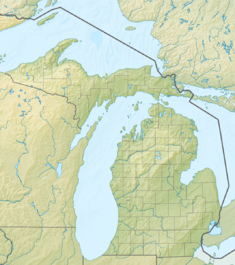
Edenville Dam was an earthen embankment dam at the confluence of the Tittabawassee River and the Tobacco River in Mid Michigan, United States, forming Wixom Lake. The dam was about one mile (1.6 km) north of Edenville, mostly in the southeast corner of Tobacco Township in Gladwin County, with its southeastern end reaching into Edenville Township in Midland County. Its height was 54 feet (16 m), the length was 6,600 feet (2,000 m) at its crest.
The dam was built in 1924[2] for hydroelectric power and flood control.[3] The dam was equipped with two 2.4 MW turbines capable of generating 4.8 MW of electricity in total.[4]
In May 2020, following heavy rains, the Edenville Dam breached and the Sanford Dam downstream overflowed, which caused major flooding in Midland County, including the city of Midland.[5]
- ^ U.S. Geological Survey Geographic Names Information System: Edenville Dam
- ^ "Dam Information – Gladwin County".
- ^ "findlakes.com". ww5.findlakes.com.[permanent dead link]
- ^ FERC issues preliminary permit for 6-MW Edenville Dam Hydroelectric Project in Michigan Archived December 8, 2020, at the Wayback Machine, December 3, 2019
- ^ Jackson, Angie; Spangler, Todd. "'Do not hesitate': Michigan governor urges evacuations, warns Midland could be under 9 feet of water". USA TODAY.

