Back Enga Province ALS Енга Bulgarian Enga BS Enga Province CEB پارێزگای ئێنگە CKB Enga Province German Enga Esperanto Provincia de Enga Spanish Enga provints Estonian Enga Basque
Enga Province
Enga Provins (Tok Pisin) Enga | |
|---|---|
 Flag | |
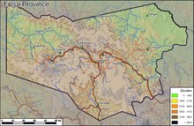
 Enga Province in Papua New Guinea | |
| Coordinates: 5°30′S 143°30′E / 5.500°S 143.500°E | |
| Country | Papua New Guinea |
| Capital | Wabag |
| Districts | |
| Government | |
| • Governor | Peter Ipatas (1997–present) |
| Area | |
| • Total | 11,704 km2 (4,519 sq mi) |
| Population (2011 census)[1] | |
| • Total | 432,045 |
| • Density | 37/km2 (96/sq mi) |
| Time zone | UTC+10 (AEST) |
| ISO 3166 code | PG-EPW |
| HDI (2018) | 0.480[2] low · 20th of 22 |
Enga is one of the provinces in Papua New Guinea (PNG). Enga is geographically situated in the northern region of Papua New Guinea and was separated from the adjacent Western Highlands at the time of national independence in 1975. The majority ethnic group are Engans. Approximately 500,000 people live within the province, which has one spoken language in all five of its districts.[3] A small minority of Engans' land on the eastern side of the region remained in the Western Highlands, their territory being accessible by road from Mount Hagen but not directly from elsewhere in Enga territory.
- ^ "Post-Courier Online". Archived from the original on 28 June 2013. Retrieved 25 June 2013.
- ^ "Sub-national HDI – Area Database". Global Data Lab. Archived from the original on 23 September 2018. Retrieved 18 April 2020.
- ^ "Enga – Department of Finance – Papua New Guinea". Archived from the original on 19 February 2024. Retrieved 19 February 2024.