Back Фаралонавы астравы Byelorussian Illes Farallon Catalan Farallon Islands CEB Farallonské ostrovy Czech Farallon-Inseln German Νησιά Φάραλλον Greek Insuloj Farajonoj Esperanto Los Farallones Spanish Farallonsaaret Finnish Îles Farallon French
| Farallon Islands National Wildlife Refuge | |
|---|---|
 Southeast Farallon Islands from the west, with Maintop Island in the foreground (right) | |
 | |
| Location | Pacific Ocean |
| Nearest city | San Francisco, California, United States |
| Coordinates | 37°43′30″N 123°01′49″W / 37.7249303°N 123.0302779°W |
| Area | 41.9 acres (17.0 ha) |
| Established | 1969 |
| Governing body | United States Fish and Wildlife Service |
| Website | Farallon Islands National Wildlife Refuge |
Farallon Islands | |
| Area | 211 acres (85.4 ha) |
| NRHP reference No. | 77000332[1] |
| Added to NRHP | March 8, 1977 |


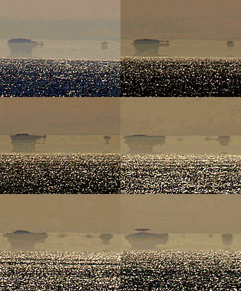
The Farallon[pronunciation?] Islands, or Farallones[pronunciation?] (from Spanish farallón 'pillar, sea cliff'), are a group of islands and sea stacks in the Gulf of the Farallones, off the coast of San Francisco, California, United States. The islands are also sometimes referred to by mariners as the Devil's Teeth Islands, in reference to the many treacherous underwater shoals in their vicinity.[2] The islands lie 30 miles (48 km) outside the Golden Gate and 20 miles (32 km) south of Point Reyes, and are visible from the mainland on clear days.[citation needed][3]The islands are part of the City and County of San Francisco. The only inhabited portion of the islands is on Southeast Farallon Island (SEFI), where researchers from Point Blue Conservation Science and the U.S. Fish and Wildlife Service stay.[4] The islands are closed to the public.[5]
The Farallon Islands National Wildlife Refuge is one of 63 national wildlife refuges that have congressionally designated wilderness status.[6] In 1974, the Farallon Wilderness was established (Public Law 93-550) and includes all islands except the Southeast Island for a total of 141 acres (57 ha).[7] Additionally, waters surrounding the islands are protected as part of the Greater Farallones National Marine Sanctuary.
- ^ "National Register Information System". National Register of Historic Places. National Park Service. March 13, 2009.
- ^ David McGuire (September 15, 2014). "Devils Teeth, Mysterious Sharks". Shark Stewards. Retrieved July 8, 2017.
- ^ Mount Tamalpais State Park [brochure], California State Parks, 2007, rev. 2016, (from brochure), "The breathtaking panorama from Mount Tamalpais's 2,571-foot peak includes the Farallon Islands 25 miles out to sea, the Marin hills, San Francisco Bay, the East Bay, and Mount Diablo."
- ^ "Point Blue | Conservation Science, PRBO". Prbo.org. Archived from the original on April 28, 2013. Retrieved June 5, 2015.
- ^ "Farallon Islands National Wildlife Refuge". Fws.gov. Archived from the original on August 1, 2018. Retrieved June 5, 2015.
- ^ "Learn About Wilderness National Wildlife Refuge System" (PDF). United States Fish and Wildlife Service. August 2013. Retrieved June 8, 2015.
- ^ "Federal Register" (PDF). Edocket.access.gpo.gov. May 31, 2005. p. 2. Retrieved June 5, 2015.