| Floreat Perth, Western Australia | |||||||||||||||
|---|---|---|---|---|---|---|---|---|---|---|---|---|---|---|---|
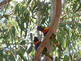
 Rainbow lorikeets at Perry Lakes | |||||||||||||||
 | |||||||||||||||
| Coordinates | 31°56′17″S 115°47′38″E / 31.938°S 115.794°E | ||||||||||||||
| Population | 8,621 (SAL 2021)[1] | ||||||||||||||
| Postcode(s) | 6014 | ||||||||||||||
| Area | 4.4 km2 (1.7 sq mi) | ||||||||||||||
| Location | 8 km (5 mi) WNW of Perth CBD | ||||||||||||||
| LGA(s) | Town of Cambridge | ||||||||||||||
| State electorate(s) | Cottesloe | ||||||||||||||
| Federal division(s) | Curtin | ||||||||||||||
| |||||||||||||||
Floreat is a residential suburb 8 kilometres (5 mi) west-northwest of the central business district of Perth, the capital of Western Australia. It is bordered on Underwood Avenue, Selby Street, Cromarty Road and Durston Road. It is the head of the Town of Cambridge, which has its municipal offices and library in the suburb. The name of the suburb stems from the Latin word for "flourish" or "prosper", which is also the motto of the City of Perth, of which Floreat was a part when it was first built.
- ^ Australian Bureau of Statistics (28 June 2022). "Floreat (suburb and locality)". Australian Census 2021 QuickStats. Retrieved 28 June 2022.
