Back Holroyd (bahin nga lungsod) CEB هولروید، نیو ساوت ولز Persian Holroyd (del av en befolkad plats) Swedish
| Holroyd Sydney, New South Wales | |||||||||||||||
|---|---|---|---|---|---|---|---|---|---|---|---|---|---|---|---|
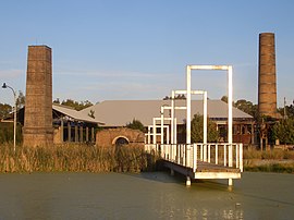
 Former brickworks | |||||||||||||||
 | |||||||||||||||
| Population | 1,275 (2016 census)[1] | ||||||||||||||
| Postcode(s) | 2142 | ||||||||||||||
| Elevation | 18 m (59 ft) | ||||||||||||||
| Location | 20 km (12 mi) W of Sydney CBD | ||||||||||||||
| LGA(s) | Cumberland Council | ||||||||||||||
| State electorate(s) | Granville | ||||||||||||||
| Federal division(s) | Parramatta | ||||||||||||||
| |||||||||||||||
Holroyd is a small suburb in western Sydney, New South Wales, Australia. Holroyd is located 20 kilometres (12 mi) west of the Sydney central business district in the local government area of the Cumberland Council. The previous local government area of Holroyd City took its name from Arthur Holroyd, first Mayor of the area, local landowner and businessman. The administrative centre is located in nearby Merrylands.
Holroyd shares the postcode of 2142 with the separate nearby suburbs of Granville, South Granville, Camellia and Rosehill.
- ^ Australian Bureau of Statistics (27 June 2017). "Holroyd (State Suburb)". 2016 Census QuickStats. Retrieved 14 March 2018.