Back هوويك (كيبك) Arabic Howick (munisipyo) CEB Howick Spanish Howick (Quebec) Basque هاویک، کبک Persian Howick French Howick (Québec) Italian Howick (kommun) Swedish
Howick | |
|---|---|
 | |
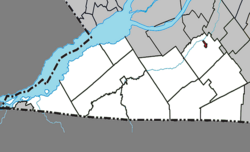
 Location within Le Haut-Saint-Laurent RCM | |
| Coordinates: 45°11′N 73°51′W / 45.183°N 73.850°W[1] | |
| Country | Canada |
| Province | Quebec |
| Region | Montérégie |
| RCM | Le Haut-Saint-Laurent |
| Constituted | October 29, 1915 |
| Government | |
| • Mayor | Richard Raithby |
| • Federal riding | Beauharnois—Salaberry |
| • Prov. riding | Huntingdon |
| Area | |
| • Total | 0.96 km2 (0.37 sq mi) |
| • Land | 0.96 km2 (0.37 sq mi) |
| Population (2021)[4] | |
| • Total | 850 |
| • Density | 885.0/km2 (2,292/sq mi) |
| • Pop (2016-21) | |
| • Dwellings | 366 |
| Time zone | UTC−5 (EST) |
| • Summer (DST) | UTC−4 (EDT) |
| Postal code(s) | |
| Area code(s) | 450 and 579 |
| Highways | |
| Website | www |
Howick is the third smallest municipality in the Canadian province of Quebec, located in Le Haut-Saint-Laurent Regional County Municipality. The population as of the 2021 Canadian census was 850. Situated along the English River in the heart of the Châteauguay Valley, it is approximately 50 minutes southwest of Montreal and 20 minutes north of the Canada–United States border.
- ^ Cite error: The named reference
toponymiewas invoked but never defined (see the help page). - ^ a b "Répertoire des municipalités: Howick". www.mamh.gouv.qc.ca (in French). Ministère des Affaires municipales et de l'Habitation. Retrieved 3 October 2023.
- ^ Riding history for Beauharnois—Salaberry, Quebec from the Library of Parliament
- ^ a b "Profile table, Census Profile, 2021 Census of Population - Howick, Municipalité (MÉ) [Census subdivision], Quebec". Government of Canada - Statistics Canada. 9 February 2022.
