This article needs additional citations for verification. (March 2007) |
| Illawarra | |
|---|---|
 Lookout from the Illawarra escarpment above Wombarra over the northern Illawarra plain viewing Austinmer, Thirroul, Bulli, Wollongong up to Port Kembla in the far distance. | |
| Highest point | |
| Peak | Bells Hill, New South Wales |
| Elevation | 803 m (2,635 ft) |
| Coordinates | 34°37′S 150°36′E / 34.617°S 150.600°E[1] |
| Dimensions | |
| Length | 92 km (57 mi) NNE[2] |
| Geography | |
| Country | Australia |
| State | New South Wales |
| Region | Illawarra |
| Range coordinates | 34°22′02″S 150°52′33″E / 34.36722°S 150.87583°E[2] |
| Geology | |
| Orogeny | Sydney Basin |
| Age of rock | Tertiary |
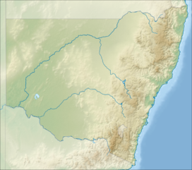
The Illawarra escarpment, or officially the Illawarra Range,[2] is the fold-created cliffs and plateau-eroded outcrop mountain range west of the Illawarra coastal plain south of Sydney, in the state of New South Wales, Australia. The range encloses the Illawarra region which stretches from Stanwell Park in the north to Kiama, Gerringong and the Shoalhaven River in the south.
Bells Hill, west of Knights Hill, is the highest point in the range at 803 metres (2,635 ft) AHD on the range's plateau; with a number of other peaks on the escarpment ranging from 300 metres (980 ft) to a maximum of 768 metres (2,520 ft) at Mount Murray southwest of Dapto.
- ^ "Bells Hill". Geographical Names Register (GNR) of NSW. Geographical Names Board of New South Wales. Retrieved 29 December 2013.
- ^ a b c "Illawarra Range". Geographical Names Register (GNR) of NSW. Geographical Names Board of New South Wales. Retrieved 29 December 2013.

