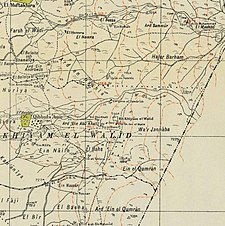
Khiyam al-Walid
خيام الوليد | |
|---|---|
Village | |
 Khiyam al-Walid was located on the eastern edge of the Hula Valley | |
| Etymology: "the tents of al-Walid" | |
A series of historical maps of the area around Khiyam al-Walid (click the buttons) | |
Location within Mandatory Palestine | |
| Coordinates: 33°08′39″N 35°39′14″E / 33.14417°N 35.65389°E | |
| Palestine grid | 211/282 |
| Geopolitical entity | Mandatory Palestine |
| Subdistrict | Safad |
| Date of depopulation | May 1, 1948[3] |
| Area | |
| • Total | 4,215 dunams (4.215 km2 or 1.627 sq mi) |
| Population (1945) | |
| • Total | 280[1][2] |
| Cause(s) of depopulation | Fear of being caught up in the fighting |
| Current Localities | Lehavot HaBashan[4] |
Khiyam al-Walid (Arabic: خيام الوليد) was a Palestinian Arab village in the Safad Subdistrict located 25.5 kilometers (15.8 mi) northeast of Safad along the Syrian border. It was on situated on a hill 150 meters (490 ft) above sea level on the eastern edge of the Hula Valley. In 1945, there were 280 predominantly Muslim inhabitants. It was depopulated during the 1948 Palestine War.[4]
- ^ Department of Statistics, 1945, p. 10
- ^ Government of Palestine, Department of Statistics. Village Statistics, April, 1945. Quoted in Hadawi, Village Statistics, 1945. PLO Research Center, 1970, p.70
- ^ Morris, 2004, p. xvi, village #22. Also gives cause of depopulation.
- ^ a b Khalidi, 1992, p.466.


