| Marusudar | |
|---|---|
 | |
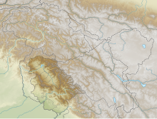
 River map of Jammu and Kashmir | |
| Location | |
| Country | India |
| Flows through | Marwah-Dachhan in Kishtwar district, Jammu and Kashmir |
| Physical characteristics | |
| Source | Nunkun glacier |
| • location | Warwan Valley, Kishtwar, Jammu and Kashmir, India |
| • coordinates | 33°27′25.77″N 75°48′48.99″E / 33.4571583°N 75.8136083°E |
| Mouth | Chenab river |
• location | Bhandarkoot, Kishtwar district, Jammu and Kashmir |
| Length | 133 km (83 mi) approx. |
| Basin features | |
| Dams | Pakal Dul Dam, Bursar Dam |
Marusudar river or Maru Sudar river is the largest river tributary of the Chenab River, beginning at the Nunkun glacier of the Warwan Valley and joining the Chenab at Bhandarkoot in the Kishtwar district. As of 2021, 1000MW Pakal Dul Dam the 800MW Bursar Hydroelectric Project are under construction on this river.
