Back Мърдър Тидфил (графство) Bulgarian Merthyr Tudful Breton Merthyr Tydfil County Borough CEB Merthyr Tudful (sir) Welsh Merthyr Tydfil County Borough German Merthyr Tydfil (autoridad unitaria) Spanish Merthyr Tydfil Basque شهرستان مستقل مرثر تیدویل Persian Merthyr Tydfil (borough de comté) French Merthyr Tydfil County Borough FRR
Merthyr Tydfil County Borough
Bwrdeistref Sirol Merthyr Tudful (Welsh) | |
|---|---|
| |
 | |
| Admin HQ | Merthyr Tydfil |
| Largest town | Merthyr Tydfil |
| Government | |
| • Type | Merthyr Tydfil County Borough Council |
| • Control | Labour |
| • MPs | |
| • MSs |
|
| Area | |
| • Total | 111 km2 (43 sq mi) |
| • Rank | Ranked 21st |
| Population (2022) | |
| • Total | 58,883 |
| • Rank | Ranked 22nd |
| • Density | 528/km2 (1,370/sq mi) |
| • Rank | Ranked 9th |
| • Ethnicity | 99.6% White |
| Welsh language | |
| • Rank | Ranked 15th |
| • Speakers | 8.9%[1] |
| Geocode | 00PH (ONS) W06000024 (GSS) |
| ISO 3166 code | GB-MTY |
| Website | www |
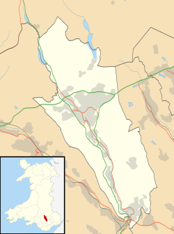
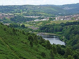
Merthyr Tydfil County Borough (Welsh: Bwrdeistref Sirol Merthyr Tudful) is a county borough (since 1908) in the south-east of Wales. In mid 2018, it had an estimated population of 60,183 [2] making it the smallest local authority in Wales by both population and land area. It is located in the historic county of Glamorgan and takes its name from the town with the same name. The county borough consists of the northern part of the Taff Valley and the smaller neighbouring Taff Bargoed Valley. It borders the counties of Rhondda Cynon Taf to the west, Caerphilly County Borough to the east, and Powys to the north.


