Back Mzimba dairəsi Azerbaijani Мзимба Bulgarian Mzimba (distrig) Breton Districte de Mzimba Catalan Mzimba District CEB Distrito de Mzimba Spanish بخش مزیمبا Persian Mzimban piirikunta Finnish District de Mzimba French Distrito de Mzimba Galician
Mzimba | |
|---|---|
District | |
 Mzuzu Shoprite Centre Opposite Katoto Filling Station in Mzimba District | |
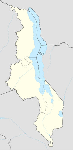
| Coordinates: 11°30′S 33°30′E / 11.500°S 33.500°E | |
| Country | Malawi |
| Region | Northern Region |
| Capital | Mzimba |
| Established | 1908 |
| Government | |
| • Type | Unitary presidential republic |
| Area | |
| • Total | 10,473 km2 (4,044 sq mi) |
| Population (2023[2]) | |
| • Total | 1,017,701[1] |
| Racial makeup (2023) | |
| • Black African | 94.1% |
| • Asian | 2.6% |
| • Mixed | 1.9% |
| • White | 1.3% |
| • Other | 0.1% |
| First languages (2018) | |
| • Chitumbuka | 93.2% |
| • Chichewa | 2.8% |
| • Yao | 1.5% |
| • Lomwe | 1.1% |
| • English | 0.2% |
| • Other | 1.1% |
| Time zone | UTC+2 (CAT) |
| ISO 3166 code | MW-MZ |
Mzimba is a district in the Northern Region of Malawi. The capital is Mzimba and the biggest town is Mzuzu, which is also the administrative headquarters of the Northern Region. The district covers an area of 10,473 km2 and has a population of 1,017,701 (2023).[3] It is the largest district in Malawi. The district is inhabited by descendants of Tumbuka and few Ngoni people. Chitumbuka is the predominat language spoken in the district.[3]
- ^ "Mzimba (District, Malawi) - Population Statistics, Charts, Map and Location". www.citypopulation.de. Retrieved 2024-06-13.
- ^ "Mzimba (District, Malawi) - Population Statistics, Charts, Map and Location". www.citypopulation.de. Retrieved 2024-06-13.
- ^ a b https://www.citypopulation.de/en/malawi/admin/northern/MW105__mzimba/
