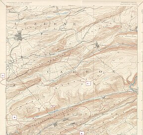
| Nesquehoning Mountain[1] | |
|---|---|
| Nesquehoning Ridge[2] | |
| Highest point | |
| Peak | Lat/Lng:405000N 0755457W [1] |
| Elevation | 1,535 ft (468 m) |
| Coordinates | 40°50′0″N 75°54′57″W / 40.83333°N 75.91583°W |
| Dimensions | |
| Length | 25 mi (40 km) east-west |
| Width | 1–2 km (0.62–1.24 mi) north-south |
| Geography | |
| Country | United States |
| State | Pennsylvania |
| Borders on | Ridge-and-Valley Appalachians and Great Appalachian Valley |
| Geology | |
| Orogeny | Appalachian Mountains |
| Age of rock | Silurian |
| Type of rock | Tuscarora Formation and Shawangunk Formation; sedimentary |
Nesquehoning Mountain[3] or Nesquehoning Ridge[2] is a 15–17-mile-long (24–27 km) coal bearing ridge dividing the waters of Lehigh Valley to the north from the Schuylkill River valley and the several near parallel ridgelines of the Ridge-and-valley Appalachians barrier range all local members of which run generally WSW-ENE in the greater overall area.
Nestled above a creek sculpted ravine across from the even less negotiable sides of Broad Mountain the flanks above Nesquehoning Creek reach a sharp bend cut by the water gap of the Lehigh River and merge with the ridge of Pisgah Ridge to the south into a common terminal mountain, Mount Pisgah within sight of the Poconos in a region once touted as "The Switzerland of America" along the eastern edge of the Southern Anthracite Region, all several ridge lines north of Blue Mountain,[4] which in part provides the source waters for Nesquehoning Creek, a tributary of the Lehigh River in the Poconos in Northeastern Pennsylvania.
- ^ a b "Nesquehoning Mountain". Geographic Names Information System. United States Geological Survey, United States Department of the Interior. Retrieved 2013-09-26.
- ^ a b See USGS map names on commons:File:Schuylkill-Lehigh River Drainage Divides USGS, Hazelton-Mauch Chunk & Mountain Quads, NW+NE-4.jpg
- ^ USGS Geographic Names Information System search, quote='Nesquehoning Mountain ID# 1193008 Type:Summit County: Schuylkill,PA Lat/Lng:405000N 0755457W (peak) Peak Elevation: 1,535 feet (468 m) USGS 15' Quadrant Map name: Tamaqua - Entry date: 02-AUG-1979'
- ^ U.S. Geological Survey, accessed September 21, 2013

