Back Quelimane Afrikaans كيليماني Arabic كيليمانى ARZ Келіманэ Byelorussian Quelimane Catalan Quelimane (kapital sa lalawigan) CEB Quelimane Czech Quelimane Danish Quelimane German Κελιμάνε Greek
This article needs additional citations for verification. (April 2022) |
Quelimane | |
|---|---|
 Quelimane | |
| Coordinates: 17°52′35″S 36°53′14″E / 17.87639°S 36.88722°E | |
| Country | |
| Provinces | Zambezia Province |
| City Status | 1942 |
| Area | |
| • Total | 117 km2 (45 sq mi) |
| Elevation | 1 m (3 ft) |
| Population (2017 census) | |
| • Total | 349,842 |
| • Density | 3,000/km2 (7,700/sq mi) |
| Climate | Aw |
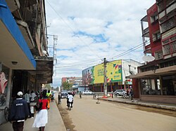
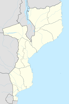
Quelimane (Portuguese pronunciation: [keliˈmani]) is a seaport in Mozambique. It is the administrative capital of the Zambezia Province and the province's largest city, and stands 25 km (16 mi) from the mouth of the Rio dos Bons Sinais (or "River of the Good Signs"). The river was named when Vasco da Gama, on his way to India, reached it and saw "good signs" that he was on the right path. The town was the end point of David Livingstone's west-to-east crossing of south-central Africa in 1856. Portuguese is the official language of Mozambique, and many residents of the areas surrounding Quelimane speak Portuguese. The most common local language is Chuabo. Quelimane, along with much of Zambezia Province, is extremely prone to floods during Mozambique's rainy season.
