Back نهر رانجيتايكى ARZ Rangitaiki River (suba, lat -37,91, long 176,88) CEB Rangitaiki River German Rangitaiki (fleuve) French रंगिताइकी नदी Hindi Rangitaiki (rzeka) Polish Рангитаики (река) Russian
| Rangitaiki River | |
|---|---|
 Rangitaiki River | |
 The Rangitaiki River system | |
| Native name | Rangitaiki (Māori) |
| Location | |
| Country | New Zealand |
| Region | Bay of Plenty |
| District | Taupo, Whakatāne |
| Towns | Murupara, Edgecumbe |
| Physical characteristics | |
| Source | |
| • coordinates | 39°0′7″S 176°26′53″E / 39.00194°S 176.44806°E |
| Mouth | |
• location | Bay of Plenty |
• coordinates | 37°54′32″S 176°52′55″E / 37.90889°S 176.88194°E |
• elevation | Sea level |
| Length | 155 kilometres (96 mi) |
| Basin size | 3,005 square kilometres (1,160 sq mi) |
| Discharge | |
| • average | 74 m3/s (2,600 cu ft/s)[1] |
| Basin features | |
| Tributaries | |
| • right | Otamatea River, Wheao River, Whirinaki River, Horomanga River |
| Waterbodies | Lake Āniwaniwa, Lake Matahina |
| Waterfalls | Āniwaniwa Falls |
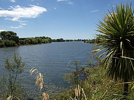
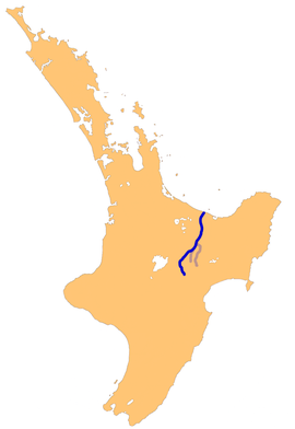
The Rangitaiki River is the longest river in the Bay of Plenty region in New Zealand's North Island. It is 155 kilometres (96 mi) long, and rises inland from northern Hawkes Bay to the east of the Kaingaroa Forest. The Rangitaiki catchment covers an area of 3005 km2.[2] It flows in a generally northeastward direction, passing through the town of Murupara and skirting close to the western edge of Te Urewera National Park before turning northwards, flowing past Edgecumbe and into the Bay of Plenty close to Thornton.
There are two man-made lakes on the Rangitaiki formed by hydro-electric dams, Lake Āniwaniwa (formerly Lake Aniwhenua).[3] and Lake Matahina.
- ^ "NIWA Water & soil miscellaneous publication no. 48 (1983)" (PDF). Archived (PDF) from the original on 13 April 2021. Retrieved 13 April 2021.
- ^ Cite error: The named reference
LAWA1was invoked but never defined (see the help page). - ^ Cite error: The named reference
DOSwas invoked but never defined (see the help page).