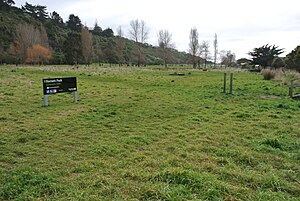
Redcliffs | |
|---|---|
 Barnett Park | |
 | |
| Coordinates: 43°33′47″S 172°43′52″E / 43.563°S 172.731°E | |
| Country | New Zealand |
| City | Christchurch |
| Local authority | Christchurch City Council |
| Electoral ward | Heathcote |
| Community board | Waihoro Spreydon-Cashmere-Heathcote |
| Area | |
| • Land | 185 ha (457 acres) |
| Population (June 2023)[2] | |
| • Total | 2,070 |
| (Avon Heathcote Estuary / Ihutai) | ||
| Mount Pleasant |
|
|
| Heathcote Valley | (Port Hills) | Moncks Bay |
Redcliffs is an outer coastal suburb of Christchurch, Canterbury, New Zealand.
- ^ Cite error: The named reference
Areawas invoked but never defined (see the help page). - ^ "Population estimate tables - NZ.Stat". Statistics New Zealand. Retrieved 25 October 2023.
