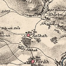
Saliha
صَلْحَة | |
|---|---|
A series of historical maps of the area around Saliha (click the buttons) | |
Location within Mandatory Palestine | |
| Coordinates: 33°04′32″N 35°27′22″E / 33.07556°N 35.45611°E | |
| Palestine grid | 192/275 |
| Geopolitical entity | Mandatory Palestine |
| Subdistrict | Safad |
| Date of depopulation | 30 October 1948[3] |
| Area | |
| • Total | 11,735 dunams (11.735 km2 or 4.531 sq mi) |
| Population (1945) | |
| • Total | 1,070 (including Maroun al-Ras and Yaroun)[1][2] |
| Cause(s) of depopulation | Military assault by Yishuv forces |
| Current localities | Yir'on[4][5] and Avivim[5] |
Saliha (Arabic: صَلْحَة), sometimes transliterated Salha, meaning 'the good/healthy place',[6] was a Palestinian Arab village located 12 kilometres northwest of Safed.
The Franco-British boundary agreement of 1920 placed Saliha within the French Mandate of Lebanon border, thus classifying it a part of Lebanese territory.[7][8] It was one of the 24 villages transferred from the French mandate of Lebanon to British control in 1924 in accordance with the 1923 demarcation of the border between the Mandatory Palestine and the French Mandate for Syria and the Lebanon. It thus formed part of Palestine until 1948.[citation needed]
Under the 1948 United Nations Partition Plan for Palestine, Saliha was to be included in the proposed Arab state, while the boundary between it and the proposed Jewish state was to run north of the built-up area of the village.[9]
During the 1948 Arab-Israeli war, Saliha was the site of a massacre carried out by Israeli forces shortly before the village was completely depopulated.[10] The built structures in the village, with the exception of an elementary school for boys, were also destroyed.[11]
- ^ a b Government of Palestine, Department of Statistics. Village Statistics, April, 1945. Quoted in Hadawi, 1970, p. 71 Archived 2011-06-04 at the Wayback Machine
- ^ Department of Statistics, 1945, p. 11
- ^ Morris, 2004, p. xvi, village #34. Also gives cause of depopulation.
- ^ Morris, 2004, p. xxii, Settlement #161, established 1949-50.
- ^ a b Khalidi, 1992, p.492
- ^ William Lancaster, Fidelity Lancaster, People, Land and Water in the Arab Middle East: Environments and Landscapes in the Bilâd ash-Shâm, Routledge 2013, p.98
- ^ Kaufman, Asher (2006). "Between Palestine and Lebanon: Seven Shi'i Villages as a Case Study of Boundaries, Identities, and Conflict". Middle East Journal. 60 (4): 685–706. doi:10.3751/60.4.13. JSTOR 4330318.
- ^ "The Franco-British [Boundary] Convention of December 23, 1920". Archived from the original on 2009-02-05. Retrieved 2009-11-25.
- ^ Moore, 2004, p. 160.
- ^ Morris, 2004, p. 498
- ^ Cite error: The named reference
PRwas invoked but never defined (see the help page).


