Back Southbourne CEB Southbourne, Gorllewin Sussex Welsh Southbourne LLD Southbourne Dutch Southbourne (West Sussex) Polish Southbourne Swedish Southbourne, West Sussex Turkish Southbourne ZH-MIN-NAN
| Southbourne | |
|---|---|
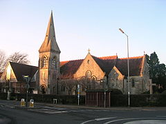
 St. John's Church | |
Location within West Sussex | |
| Area | 10.68 km2 (4.12 sq mi) [1] |
| Population | 6,265. 2011 Census[2] |
| • Density | 562/km2 (1,460/sq mi) |
| OS grid reference | SU769056 |
| • London | 57 miles (92 km) NE |
| Civil parish |
|
| District | |
| Shire county | |
| Region | |
| Country | England |
| Sovereign state | United Kingdom |
| Post town | EMSWORTH |
| Postcode district | PO10 |
| Dialling code | 01243 |
| Police | Sussex |
| Fire | West Sussex |
| Ambulance | South East Coast |
| UK Parliament | |
Southbourne is a village and civil parish in the Chichester district of West Sussex, England. It lies to the east of the Hampshire County Border at Emsworth, the west of Chidham (recently the boundary has been changed) and south-east of Westbourne. Southbourne parish comprises Lumley, Hermitage, Thornham, Prinsted and part of Nutbourne.
- ^ "2001 Census: West Sussex – Population by Parish" (PDF). West Sussex County Council. Archived from the original (PDF) on 8 June 2011. Retrieved 17 May 2009.
- ^ "Civil parish population 2011". Retrieved 16 October 2015.
