Back نهر سويتواتر ARZ Sweetwater River (North Platte River) German Río Sweetwater Spanish Sweetwater (Wyoming) Italian Sweetwater (rivier) Dutch Sweetwater River (Wyoming) Polish Rio Sweetwater (Wyoming) Portuguese Суитуотер (приток Норт-Платта) Russian Sweetwater River (flod i Wyoming) Swedish 斯威特沃特河 (怀俄明州) Chinese
| Sweetwater River | |
|---|---|
 1870 photograph of the Sweetwater River. | |
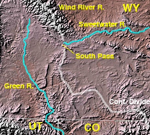
 North Platte, Sweetwater Rivers across Wyoming | |
| Location | |
| Country | United States |
| State | Wyoming |
| Cities | Sweetwater Station, Jeffrey City |
| Physical characteristics | |
| Source | Sweetwater Gap |
| • location | Wind River Range, Fremont County |
| • coordinates | 42°39′15″N 109°03′25″W / 42.65417°N 109.05694°W[1] |
| • elevation | 10,200 ft (3,100 m) |
| Mouth | North Platte River |
• location | Pathfinder Reservoir, Natrona County |
• coordinates | 42°30′25″N 109°03′25″W / 42.50694°N 109.05694°W[1] |
• elevation | 5,853 ft (1,784 m) |
| Length | 238 mi (383 km)[2] |
| Basin size | 2,880 sq mi (7,500 km2)[3] |
| Discharge | |
| • location | above Pathfinder Reservoir[4] |
| • average | 120.8 cu ft/s (3.42 m3/s)[4] |
| • minimum | 0.5 cu ft/s (0.014 m3/s) |
| • maximum | 4,290 cu ft/s (121 m3/s) |

The Sweetwater River is a 238-mile (383 km) long tributary of the North Platte River,[2] in the U.S. state of Wyoming. As a part of the Mississippi River system, its waters eventually reach the Gulf of Mexico.
- ^ a b "Sweetwater River". Geographic Names Information System. United States Geological Survey, United States Department of the Interior. 1979-06-05. Retrieved 2015-12-10.
- ^ a b U.S. Geological Survey. National Hydrography Dataset high-resolution flowline data. The National Map, accessed March 21, 2011
- ^ "Boundary Descriptions and Names of Regions, Subregions, Accounting Units and Cataloging Units". United States Geological Survey. Retrieved 2015-12-10.
- ^ a b "USGS Gage #06639000 on the Sweetwater River near Alcova, WY" (PDF). National Water Information System. U.S. Geological Survey. 1913–2013. Retrieved 2015-12-09.