Back متنزه دبليو الوطني Arabic Parc nacional de la W Catalan Národní park W Czech Parc Cenedlaethol W Welsh W (nationalpark) Danish Nationalpark W German डब्लु राष्ट्रिय निकुञ्ज DTY Εθνικό Πάρκο W του Νίγηρα Greek Nacia Parko W Esperanto Parque nacional W Spanish
| W Transborder Park | |
|---|---|
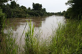
 Mékrou River in the W-National Park | |
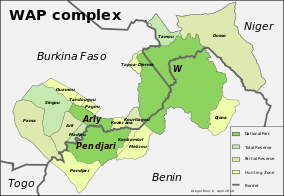
 IUCN Protected Areas of the WAP complex | |
| Location | Niger-Burkina Faso-Benin |
| Nearest city | Kandi (Benin), Diapaga (Burkina Faso), Tapoa (Niger) |
| Coordinates | 12°31′31″N 2°39′48″E / 12.52528°N 2.66333°E |
| Area | 10,000 km2 (3,900 sq mi) |
| Established | August 4, 1954 |
| Governing body | ECOPAS, Governments of Niger, Burkina Faso, and Benin |
| Official name | W Regional Park |
| Type | Natural |
| Criteria | vii, ix, x |
| Designated | 1996 (20th session) |
| Reference no. | 749bis |
| Region | Africa |
| Official name | Parc national du W |
| Designated | 30 April 1987 |
| Reference no. | 355[1] |
| Official name | Parc National du W |
| Designated | 27 June 1990 |
| Reference no. | 492[1] |
| Official name | Site Ramsar du Complexe W |
| Designated | 2 February 2007 |
| Reference no. | 1668[1] |
The W National Park (French: Parc national du W)[1] or W Regional Park (French: W du Niger) is a major national park in West Africa around a meander in the Niger River shaped like the letter W (French: double v). The park includes areas of the three countries Niger, Benin and Burkina Faso, and is governed by the three governments. Until 2008, the implementation of a regional management was supported by the EU-funded project ECOPAS (Protected Ecosystems in Sudano-Sahelian Africa, French: Ecosystèmes protégés en Afrique soudano-sahélienne). The three national parks operate under the name W Transborder Park (French: Parc Regional W).[2] The section of W National Park lying in Benin, measuring over 8,000 km2 (3,100 sq mi), came under the full management of African Parks in June 2020.[3] In Benin, W National Park is contiguous with Pendjari National Park which is also under the management of African Parks.
- ^ a b c d "Parc national du W". Ramsar Sites Information Service. Retrieved 25 April 2018.
- ^ parc-w.net: Official site.
- ^ "Benin Government Commits to Long-term Protection of W National Park in Benin".