Back Budapèst ACE Будапешт ADY Boedapest Afrikaans Budapest ALS ቡዳፔስት Amharic Budapest AN Budapest ANG بودابست Arabic بوداپيست ARY بودابيست ARZ
Budapest | |
|---|---|
| Capital City of Hungary Magyarország fővárosa | |
Clockwise from top: the Danube with Matthias Church in the background, Buda Castle seen from Gellért Hill, Hungarian Parliament, Heroes' Square, St. Stephen's Basilica | |
| Nicknames: Heart of Europe, Queen of the Danube, Pearl of the Danube, Capital of Freedom, Capital of Spas and Thermal Baths, Capital of Festivals | |
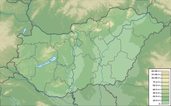
| Coordinates: 47°29′33″N 19°03′05″E / 47.49250°N 19.05139°E | |
| Country | Hungary |
| Region | Central Hungary |
| Unification of Buda, Pest and Óbuda | 17 November 1873 |
| Government | |
| • Type | Mayor – Council |
| • Body | General Assembly of Budapest |
| • Mayor | Gergely Karácsony (Dialogue) |
| Area | |
| • Capital city | 525.2 km2 (202.8 sq mi) |
| • Urban | 2,538 km2 (980 sq mi) |
| • Metro | 7,626 km2 (2,944 sq mi) |
| Elevation | Lowest (Danube) 96 m Highest (János Hill) 527 m (315 to 1,729 ft) |
| Population | |
| • Capital city | 1,752,286[1] |
| • Rank | 1st (9th in EU) |
| • Density | 3,388/km2 (8,770/sq mi) |
| • Urban | 2,997,958[5] |
| • Metro | 3,011,598[4] |
| Demonyms | Budapester, budapesti (Hungarian) |
| Time zone | UTC+1 (CET) |
| • Summer (DST) | UTC+2 (CEST) |
| Postal code(s) | 1011–1239 |
| Area code | 1 |
| ISO 3166 code | HU-BU |
| NUTS code | HU101 |
| HDI (2018) | 0.901[9] – very high · 1st |
| Website | BudapestInfo Official Government Official |
| Official name | Budapest, including the Banks of the Danube, the Buda Castle Quarter and Andrássy Avenue |
| Criteria | Cultural: ii, iv |
| Reference | 400 |
| Inscription | 1987 (11th Session) |
| Extensions | 2002 |
| Area | 473.3 ha |
| Buffer zone | 493.8 ha |
Budapest is the capital and largest city of Hungary. It was made as such in 1873. In that year, three towns on the River Danube, namely Buda, Óbuda (Old Buda) and Pest were united. About 1.7 million people live in the city. Its highest place is János Hill (527 m).
- ↑ "Population by type of settlement – annually". Hungarian Central Statistical Office. 12 April 2016. Retrieved 12 April 2016.
- ↑ "The Municipality of Budapest (official)". 11 September 2014. Retrieved 11 September 2014.
- ↑ "Budapest". Encyclopædia Britannica. 11 September 2014. Retrieved 11 September 2014.
- ↑ "Metropolitan Area Populations". Eurostat. 21 October 2019. Retrieved 18 November 2019.
- ↑ "Functional Urban Areas – Population on 1 January by age groups and sex – 2019". Eurostat. 2020. Retrieved 18 November 2019.
- ↑ "Best view in Budapest from the city's highest hilltop". stay.com – Budapest. 11 September 2014. Archived from the original on 23 June 2010. Retrieved 11 September 2014.
- ↑ "Gazetteer of Hungary, Hungarian Central Statistical Office, 2012" (PDF). Retrieved 2 October 2013.
- ↑ "Budapest City Review". Euromonitor International. December 2017. Retrieved 8 May 2014.
- ↑ "Sub-national HDI - Subnational HDI - Global Data Lab". globaldatalab.org.


