| Hawkesbury New South Wales—Legislative Assembly | |||||||||||||||
|---|---|---|---|---|---|---|---|---|---|---|---|---|---|---|---|
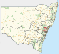
Interactive map of district boundaries from the 2023 state election | |||||||||||||||
| State | New South Wales | ||||||||||||||
| Dates current | 1859–1920 1927–present | ||||||||||||||
| MP | Robyn Preston | ||||||||||||||
| Party | Liberal | ||||||||||||||
| Namesake | Hawkesbury River | ||||||||||||||
| Electors | 55,753 (2019) | ||||||||||||||
| Area | 3,171.18 km2 (1,224.4 sq mi) | ||||||||||||||
| Demographic | Outer-metropolitan | ||||||||||||||
| |||||||||||||||
Hawkesbury is an electoral district of New South Wales. It was created in 1859, abolished in 1920 and recreated in 1927.
It is a conservative electorate in the Hawkesbury region of New South Wales. Hawkesbury contains a variety of places, including the far northern outskirts of Sydney, a small part of the Central Coast, and some rural towns.


