Back Fort Sumter Afrikaans حصن سمتر Arabic Fort Sumter Breton Fort Sumter Catalan Fort Sumter Czech Fort Sumter Danish Fort Sumter German Fort Sumter English Fort Sumter Esperanto Fort Sumter Spanish
| Fort Sumter | |
|---|---|
IUCN category V (protected landscape/seascape) | |
 | |
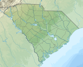
| Location | Charleston Harbor, Charleston, South Carolina |
| Coordinates | 32°45′8″N 79°52′29″W / 32.75222°N 79.87472°W |
| Area | 234.74 acres (95.00 ha)[1] |
| Authorized | April 28, 1948 |
| Visitors | 857,883 |
| Website | Fort Sumter and Fort Moultrie National Historical Park |
Fort Sumter | |
| Built | 1811 |
| NRHP reference No. | 66000101 |
| Added to NRHP | October 15, 1966 |
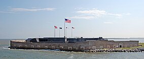
Fort Sumter is a island fortification in Charleston, South Carolina.[2] The fort was where the American Civil War began.[3] On April 12, 1861, Confederate artillery opened fire on the fort. The Union garrison, under the command of Major Robert Anderson, surrendered the fort 34 hours later. Union forces attempted to take the fort back several times during the Civil War. The fort was abandoned by Confederate forces when the Union Army, under the command of Maj. Gen. William Tecumseh Sherman captured Charleston in February 1865.[2]
- ↑ "Listing of acreage – December 31, 2011" (XLSX). Land Resource Division, National Park Service. Retrieved May 14, 2012. (National Park Service Acreage Reports)
- ↑ 2.0 2.1 "Fort Sumter". History Vault. A&E Television Networks, LLC. Retrieved 28 September 2016.
- ↑ "Where the American Civil War Began". Fort Sumter National Monument, South Carolina. National Park Service. Retrieved 28 September 2016.

