Back مطار لاى نادزاب ARZ Lae Nadzab Airport CEB Flughafen Lae Nadzab German فرودگاه لای نادزاب Persian Bandar Udara Lae Nadzab ID Aeroporto Nadzab Italian Lapangan Terbang Nadzab Malay Port lotniczy Lae Nadzab Polish Фурудгоҳи ло нодзоб Tajik
Lae Nadzab Airport | |||||||||||
|---|---|---|---|---|---|---|---|---|---|---|---|
 | |||||||||||
| Summary | |||||||||||
| Airport type | Public | ||||||||||
| Elevation AMSL | 238 ft / 72.5 m | ||||||||||
| Coordinates | 6°34′11″S 146°43′34″E / 6.56972°S 146.72611°E | ||||||||||
| Map | |||||||||||
| Runways | |||||||||||
| |||||||||||
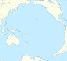
Officially named Nadzab Tomodachi International Airport,[1] Nadzab Airport is a regional airport located at Nadzab 42 kilometres (26 mi) outside Lae, Morobe Province, Papua New Guinea along the Highlands Highway. It is served by both private and regional aircraft with domestic flights. The airport replaced the Lae Airfield in 1977.
Nadzab is located on the Erap River, 5 kilometres (3.1 mi) North of the Markham River. The settlements of Gabmatsung/Gabmatzung and Gabsonkek are located on the East side of the airport.[2]
- ^ "Nadzab airport renamed". 20 April 2023.
- ^ SB 55-10 Markham (5.4 MB). "Series T504, U.S. Army Map Service". Home > Finding Information > PCL Map Collection > New Guinea AMS Topographic Maps. University of Texas at Austin. Retrieved 4 March 2014.
{{cite web}}: CS1 maint: numeric names: authors list (link)

