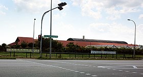
Lim Chu Kang | |
|---|---|
| Other transcription(s) | |
| • Chinese | 林厝港 Líncuògǎng (Pinyin) Lîm-chhù-káng (Hokkien POJ) |
| • Malay | Lim Chu Kang |
| • Tamil | லிம் சூ காங் Lim cū kāṅ (Transliteration) |
From top left to right: Koon Lee Nursery, Kranji Transmitting Station, Lim Chu Kang Road, Sungei Buloh Wetland Reserve, Chinese Cemetery Path 4, gravestones in Choa Chu Kang Chinese Cemetery | |
 Location of Lim Chu Kang in Singapore | |
| Coordinates: 01°25′N 103°42′E / 1.417°N 103.700°E | |
| Country | |
| Region | North Region
|
| CDC | |
| Town councils |
|
| Constituencies | |
| Government | |
| • Mayor | South West CDC
|
| • Members of Parliament | Chua Chu Kang GRC
|
| Area | |
| • Total | 17.3 km2 (6.7 sq mi) |
| • Rank | 13th |
| Population (2018)[1] | |
| • Total | 110 |
| • Rank | 42nd |
| • Density | 6.4/km2 (16/sq mi) |
| • Rank | 43rd |
| Postal district | 24 |
Lim Chu Kang is a planning area located in the northwestern part of the North Region of Singapore, bordering the Western Water Catchment to the west and south, Sungei Kadut to the east and the Straits of Johor to the north.


