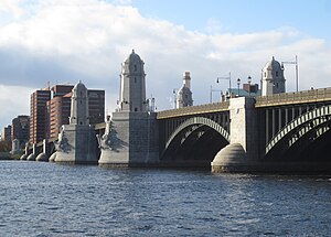
Longfellow Bridge | |
|---|---|
 Longfellow Bridge viewed from the Boston end in 2019 | |
| Coordinates | 42°21′42″N 71°04′31″W / 42.361635°N 71.07541°W |
| Carries | |
| Crosses | Charles River |
| Locale | Boston, Massachusetts to Cambridge, Massachusetts |
| Maintained by | Massachusetts Department of Transportation |
| Characteristics | |
| Design | Steel rib arch bridge |
| Total length | 1,767.5 feet (538.7 m)[1] |
| Width | 105 feet (32 m)[1] |
| Longest span | 188.5 feet (57.5 m)[1] |
| History | |
| Construction start | July 1900[1] |
| Opened | August 3, 1906 |
| Rebuilt | 2013–2018 |
| Statistics | |
| Daily traffic | 28,600 cars and 90,000 mass-transit passengers |
| Location | |
 | |
The Longfellow Bridge is a steel rib arch bridge spanning the Charles River to connect Boston's Beacon Hill neighborhood with the Kendall Square area of Cambridge, Massachusetts. The bridge carries Massachusetts Route 3, the MBTA Red Line, bicycle, and pedestrian traffic. The structure was originally known as the Cambridge Bridge, and a predecessor structure was known as the West Boston Bridge; Boston also continued to use "West Boston Bridge" officially for the new bridge. The bridge is also known to locals as the "Salt-and-Pepper Bridge"[2] due to the shape of its central towers.[3]
The bridge falls under the jurisdiction and oversight of the Massachusetts Department of Transportation (MassDOT).[4] The bridge carries approximately 28,600 cars and 90,000 mass-transit passengers every weekday.[5] A portion of the MBTA subway's elevated Charles/MGH station lies at the eastern end of the bridge, which connects to Charles Circle.
- ^ a b c d Jackson, William (1909). Report of the Cambridge bridge commission and report of the chief engineer upon the construction of Cambridge bridge. Printing department. p. 42. OL 7015322M.
{{cite book}}: Unknown parameter|agency=ignored (help) - ^ Angelo, William J. (June 6, 2007). "Salt and Pepper Bridge Slated For Major Rehab in Boston". Engineering News-Record. The McGraw-Hill Companies. Archived from the original on June 3, 2013. Retrieved December 11, 2011.
- ^ A Record of the Streets, Alleys, Places, Etc. in the City of Boston. City of Boston Printing Department. 1910. p. 493. Retrieved 25 February 2017.
- ^ "Bridge Rehabilitation, Cambridge Street over the Charles River". Mhd.state.ma.us. Archived from the original on 2011-04-10. Retrieved 2011-08-31.
- ^ "MassDOT Highway Division: Longfellow Bridge Rehabilitation Project". Boston, Massachusetts: MassDOT (Commonwealth of Massachusetts). 2010. Archived from the original on 2010-08-04. Retrieved 2010-08-22.
The bridge presently carries 28,000 motor vehicles, 90,000 transit users, and significant numbers of pedestrians and bicyclists each day.
