Back Benede-Egipte Afrikaans مصر السفلى Arabic مصر السفلى ARZ Aşağı Misir Azerbaijani Долен Египет Bulgarian Goueled Egipt Breton Donji Egipat BS Baix Egipte Catalan Dolní Egypt Czech Unterägypten German
Lower Egypt ⲧⲥⲁϧⲏⲧ, ⲡⲥⲁⲙⲉⲛϩⲓⲧ مصر السفلى | |||||||||
|---|---|---|---|---|---|---|---|---|---|
| c. 3500 BC–c. 3100 BC | |||||||||
| Capital | Memphis | ||||||||
| Common languages | Ancient Egyptian | ||||||||
| Religion | Ancient Egyptian religion | ||||||||
| Government | Monarchy | ||||||||
| King | |||||||||
• Unknown | Unknown (first) | ||||||||
• c. 3150 BC | Unknown (last) | ||||||||
| History | |||||||||
• Established | c. 3500 BC | ||||||||
• Disestablished | c. 3100 BC | ||||||||
| |||||||||
| Today part of | Egypt | ||||||||
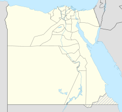
Map of Lower Egypt showing important sites that were occupied during the Protodynastic Period of Egypt (clickable map)


Lower Egypt (Arabic: مصر السفلى Miṣr as-Suflā; Coptic: ⲧⲥⲁϧⲏⲧ, romanized: Tsakhet) is the northernmost region of Egypt, which consists of the fertile Nile Delta between Upper Egypt and the Mediterranean Sea, from El Aiyat, south of modern-day Cairo, and Dahshur. Historically, the Nile River split into seven branches of the delta in Lower Egypt.
Lower Egypt was divided into nomes and began to advance as a civilization after 3600 BC.[1] Today, it contains two major channels that flow through the delta of the Nile River – Mahmoudiyah Canal (ancient Agathos Daimon) and Muways Canal (Arabic: بحر موَيس, "waterway of Moses").
