Back Nīweportnīwes ANG نيوبورت نيوز Arabic نيوبورت نيوز (ڤيرچينيا) ARZ نیوپورت نیوس، ویرجینیا AZB Newport News BAR Ньюпарт-Ньюс Byelorussian Нюпорт Нюз Bulgarian নিউপোর্ট নিউজ, ভার্জিনিয়া Bengali/Bangla Newport News Breton Newport News Catalan
Newport News, Virginia | |
|---|---|
| Corporation of Newport News | |
 Newport News Victory Arch | |
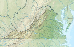
 Location of Newport News in Virginia | |
| Coordinates: 37°4′15″N 76°29′4″W / 37.07083°N 76.48444°W | |
| Country | United States |
| State | Virginia |
| Settled | 1691[1] |
| Incorporated | 1896 |
| Government | |
| • Mayor | Phillip Jones (I)[citation needed] |
| Area | |
| • Independent city | 119.62 sq mi (309.81 km2) |
| • Land | 68.99 sq mi (178.68 km2) |
| • Water | 50.63 sq mi (131.14 km2) 42.4% |
| Elevation | 15 ft (5 m) |
| Population (2020) | |
| • Independent city | 186,247 |
| • Rank | 140th In the United States 5th In Virginia |
| • Density | 2,699.62/sq mi (1,042.33/km2) |
| • Urban | 1,439,666 |
| • Metro | 1,672,319 |
| Time zone | UTC−5 (EST) |
| • Summer (DST) | UTC−4 (EDT) |
| ZIP code | 23601-23609 |
| Area code(s) | 757, 948 |
| FIPS code | 51-56000[3] |
| GNIS feature ID | 1497043[4] |
| Website | www.nnva.gov |
Newport News (/ˌnuːpɔːrt -, -pərt -/)[6] is an independent city in the Commonwealth of Virginia in the United States. At the 2020 census, the population was 186,247.[5] Located in the Hampton Roads region, it is the fifth-most populous city in Virginia and 140th-most populous city in the United States.
Newport News is included in the Hampton Roads metropolitan area. It is at the southeastern end of the Virginia Peninsula, on the northern shore of the James River extending southeast from Skiffe's Creek along many miles of waterfront to the river's mouth at Newport News Point on the harbor of Hampton Roads. Most of the area now known as Newport News was once a part of Warwick County. Warwick County was one of the eight original shires of Virginia, formed by the House of Burgesses in the British Colony of Virginia by order of King Charles I in 1634.
In 1881, fifteen years of rapid development began under the leadership of Collis P. Huntington, whose new Peninsula Extension of the Chesapeake and Ohio Railway from Richmond opened up means of transportation along the Peninsula and provided a new pathway for the railroad to bring West Virginia bituminous coal to port for coastal shipping and worldwide export. With the new railroad came a terminal and coal piers where the colliers were loaded. Within a few years, Huntington and his associates also built a large shipyard. In 1896, the new incorporated town of Newport News, which had briefly replaced Denbigh as the seat of Warwick County, had a population of 9,000. In 1958, by mutual consent by referendum, Newport News was consolidated with the former Warwick County (itself a separate city from 1952 to 1958), rejoining the two localities to approximately their pre-1896 geographic size. The more widely known name of Newport News was selected as they formed what was then Virginia's third largest independent city in population.[7]
With many residents employed at the expansive Newport News Shipbuilding, the joint U.S. Air Force–Army installation at Joint Base Langley–Eustis, and other military bases and suppliers, the city's economy is very connected to the military. The location on the harbor and along the James River facilitates a large boating industry which can take advantage of its many miles of waterfront. Newport News also serves as a junction between the rails and the sea with the Newport News Marine Terminals located at the East End of the city. Served by major east–west Interstate Highway 64, it is linked to other cities of Hampton Roads by the circumferential Hampton Roads Beltway, which crosses the harbor on two bridge-tunnels. Part of the Newport News/Williamsburg International Airport is in the city limits.[citation needed]
- ^ Fox, William A. (2010). Images of America: Downtown Newport News. Charleston, South Carolina: Arcadia Publishing. p. 7. ISBN 978-0-7385-8581-9. Retrieved November 3, 2018 – via Google Books.
Newport News was first settled in 1691, but was little more than farms until the late 1880s.
- ^ "2019 U.S. Gazetteer Files". United States Census Bureau. Retrieved August 7, 2020.
- ^ "U.S. Census website". United States Census Bureau. Retrieved January 31, 2008.
- ^ "US Board on Geographic Names". United States Geological Survey. October 25, 2007. Retrieved January 31, 2008.
- ^ a b "Population and Housing Unit Estimates". census.gov. Retrieved December 20, 2021.
- ^ Wells, John C. (2008). Longman Pronunciation Dictionary (3rd ed.). Longman. ISBN 978-1-4058-8118-0.
- ^ Cite error: The named reference
:0was invoked but never defined (see the help page).


