Back Districto de Neustadt an der Waldnaab AN Landkroas Neistodt an da Woidnaab BAR Districte de Neustadt an der Waldnaab Catalan Zemský okres Neustadt an der Waldnaab Czech Landkreis Neustadt an der Waldnaab Danish Landkreis Neustadt an der Waldnaab German Neustadt an der Waldnaab (district) English Distrikto Neustadt an der Waldnaab Esperanto Distrito de Neustadt an der Waldnaab Spanish نویشتادت ان در والدناب (ناحیه) Persian
| Landkreis Neustadt an der Waldnaab | ||
| Distrito | ||
|
||
| Nasod | ||
|---|---|---|
| Estado pederal | Bavaria | |
| Distrito nga gobyerno | Upper Palatinate | |
| Gitas-on | 450 m (1,476 ft) | |
| Tiganos | 49°42′42″N 12°05′14″E / 49.71167°N 12.08722°E | |
| Area | 1,430.00 km2 (552 sq mi) | |
| Population | 95,849 (2014-01-03) [1] | |
| Density | 67 / km2 (174 / sq mi) | |
| Timezone | CET (UTC+1) | |
| - summer (DST) | CEST (UTC+2) | |
| GeoNames | 3220856 | |
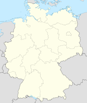
Distrito ang Landkreis Neustadt an der Waldnaab sa Alemanya.[1] Nahimutang ni sa distrito nga gobyerno sa Upper Palatinate ug estado pederal sa Bavaria, sa habagatan-sidlakang bahin sa nasod, 300 km sa habagatan sa Berlin ang ulohan sa nasod. Adunay 95,849 ka molupyo.[1] Naglangkob kin og 1,430 ka kilometro kwadrado. Landkreis Neustadt an der Waldnaab mopakigbahin sa usa ka utlanan sa Weiden, Landkreis Schwandorf, Landkreis Amberg-Sulzbach, Landkreis Tirschenreuth, Landkreis Bayreuth, Okres Domažlice, ug Okres Tachov.
Ang yuta sa Landkreis Neustadt an der Waldnaab kabungtoran sa amihang-sidlakan, apan sa habagatang-kasadpan nga kini mao ang patag.[saysay 1]
Landkreis Neustadt an der Waldnaab may sa mosunod nga mga subdibisyon:
- Windischeschenbach
- Vohenstrauß
- Pressath
- Pleystein
- Neustadt an der Waldnaab
- Neustadt am Kulm
- Grafenwöhr
- Eschenbach in der Oberpfalz
- Waldthurn
- Waidhaus
- Tännesberg
- Parkstein
- Moosbach
- Mantel
- Luhe-Wildenau
- Leuchtenberg
- Kohlberg
- Kirchenthumbach
- Floß
- Eslarn
- Schirmitz
- Püchersreuth
- Pirk
- Kirchendemenreuth
- Irchenrieth
- Georgenberg
- Flossenbürg
- Etzenricht
- Bechtsrieth
- Altenstadt an der Waldnaab
- Weiherhammer
- Vorbach
- Trabitz
- Theisseil
- Störnstein
- Speinshart
- Schwarzenbach
- Schlammersdorf
- Heinersreuther Forst
- Manteler Forst
- Speinsharter Forst
Hapit nalukop sa kabalayan ang palibot sa Landkreis Neustadt an der Waldnaab.[3] Dunay mga 476 ka tawo kada kilometro kwadrado sa palibot sa Landkreis Neustadt an der Waldnaab nga hilabihan populasyon.[4] Ang klima hemiboreal.[5] Ang kasarangang giiniton 8 °C. Ang kinainitan nga bulan Hulyo, sa 20 °C, ug ang kinabugnawan Disyembre, sa −5 °C.[6] Ang kasarangang pag-ulan 1,018 milimetro matag tuig. Ang kinabasaan nga bulan Mayo, sa 122 milimetro nga ulan, ug ang kinaugahan Marso, sa 30 milimetro.[7]
| ||||||||||||||||||||||||||||||||||||||||||||||||||||||||||||||||||||||||||||||||||||||||||||||||||||||||||||||||||||||||||||
- ↑ 1.0 1.1 1.2 Cite error: Invalid
<ref>tag; no text was provided for refs namedgn3220856 - ↑ Cite error: Invalid
<ref>tag; no text was provided for refs namedvp - ↑ Cite error: Invalid
<ref>tag; no text was provided for refs namednasalandcover - ↑ Cite error: Invalid
<ref>tag; no text was provided for refs namednasapop - ↑ Cite error: Invalid
<ref>tag; no text was provided for refs namedkoppen - ↑ 6.0 6.1 Cite error: Invalid
<ref>tag; no text was provided for refs namednasa - ↑ Cite error: Invalid
<ref>tag; no text was provided for refs namednasarain
Cite error: <ref> tags exist for a group named "saysay", but no corresponding <references group="saysay"/> tag was found


