Back Alphabet City Czech Alphabet City (Manhattan) German Alphabet City Spanish Alphabet City Basque Alphabet City Finnish Alphabet City French Alphabet City Italian アルファベット・シティ Japanese 알파벳시티 Korean Alphabet City (Manhattan) Portuguese
Alphabet City | |
|---|---|
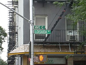
 Avenue C was designated Loisaida Avenue in recognition of the neighborhood's Puerto Rican heritage | |
 Location in New York City | |
| Coordinates: 40°43′34″N 73°58′44″W / 40.726°N 73.979°W | |
| Country | |
| State | |
| City | New York City |
| Borough | Manhattan |
| Community District | Manhattan 3[1] |
| Area | |
• Total | 1.2 km2 (0.47 sq mi) |
| Population (2020)[2] | |
• Total | 45,317 |
| • Density | 37,000/km2 (96,000/sq mi) |
| Ethnicity | |
| • White | 41.5% |
| • Hispanic | 30.6% |
| • Asian | 14.3% |
| • Black | 9.3% |
| • Other | 4.4% |
| Economics | |
| • Median income | $63,717 |
| ZIP Code | 10009 |
| Area codes | 212, 332, 646, and 917 |
| Part of a series on |
| Race and ethnicity in New York City |
|---|
Alphabet City is a neighborhood located within the East Village in the New York City borough of Manhattan. Its name comes from Avenues A, B, C, and D, the only avenues in Manhattan to have single-letter names. It is bounded by Houston Street to the south and 14th Street to the north, and extends roughly from Avenue A to the East River.[4] Some famous landmarks include Tompkins Square Park, the Nuyorican Poets Cafe and the Charlie Parker Residence.
The neighborhood has a long history, serving as a cultural center and ethnic enclave for Manhattan's German, Polish, Hispanic, and immigrants of Jewish descent. However, there is much dispute over the borders of the Lower East Side, Alphabet City, and East Village. Historically, Manhattan's Lower East Side was 14th Street at the northern end, bound on the east by East River and on the west by First Avenue; today, that same area is Alphabet City. The area's German presence in the early 20th century, in decline, virtually ended after the General Slocum disaster in 1904.
Alphabet City is part of Manhattan Community District 3 and its primary ZIP Code is 10009.[1] It is patrolled by the 9th Precinct of the New York City Police Department.
- ^ a b "NYC Planning | Community Profiles". communityprofiles.planning.nyc.gov. New York City Department of City Planning. Retrieved March 18, 2019.
- ^ a b c "Manhattan census tracts 34, 22.02, 20, 24, 26.01, 26.02, 28, 30.02, 32". NYC Population FactFinder.
- ^ "Zip code 10009". Census Reporter.
- ^ Hughes, C.J. (September 6, 2017). "Living In: Alphabet City". The New York Times.
Stretching from Avenue A to the East River, and East 14th to East Houston Streets, Alphabet City is ...