Back Amman ACE Амман ADY Amman Afrikaans አማን Amharic Ammán AN Amman ANG عمان (مدينة) Arabic ܥܡܐܢ ARC عمان (مدينه) ARZ Amán AST
Amman
عَمَّان | |
|---|---|
Capital city | |
|
| |
| Nicknames: | |
 | |
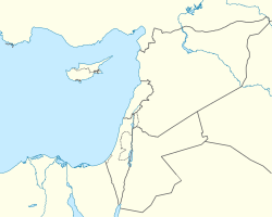
| Coordinates: 31°56′59″N 35°55′58″E / 31.94972°N 35.93278°E | |
| Country | |
| Governorate | Amman Governorate |
| Municipality | 1909 |
| Government | |
| • Mayor | Yousef Shawarbeh[3][4] |
| Area | |
• Total | 1,680 km2 (650 sq mi) |
| Highest elevation | 1,100 m (3,600 ft) |
| Lowest elevation | 700 m (2,300 ft) |
| Population (2021) | |
• Total | 4,061,150 |
| • Density | 2,380/km2 (6,200/sq mi) |
| Demonym | Ammani |
| Time zone | UTC+3 |
| Postal code | 11110-17198 |
| Area code | +962(6) |
| Website | ammancity.gov.jo |
Amman (UK: /əˈmɑːn/ ⓘ ə-MAHN, US: /ɑːˈmɑːn/ ah-MAHN; Arabic: عَمَّان, romanized: ʿAmmān, pronounced [ʕaˈmːaːn])[5][6] is the capital and the largest city of Jordan, and the country's economic, political, and cultural center.[7] With a population of four million as of 2021, Amman is Jordan's primate city and is the largest city in the Levant region, the fifth-largest city in the Arab world, and the tenth-largest metropolitan area in the Middle East.[8]
The earliest evidence of settlement in Amman dates to the 8th millennium BC in 'Ain Ghazal, home to the world's oldest statues of the human form. During the Iron Age, the city was known as Rabat Aman, the capital of the Ammonite Kingdom. In the 3rd century BC, the city was renamed Philadelphia and became one of the ten Greco-Roman cities of the Decapolis. Later, in the 7th century AD, the Rashidun Caliphate renamed the city Amman. Throughout most of the Islamic era, the city alternated between periods of devastation and periods of relative prosperity. Amman was largely abandoned during the Ottoman period from the 15th century until 1878, when it was resettled by Circassians.[9] The city grew after it was connected to the Hejaz Railway in 1904, leading to the formation of its first municipal council in 1909.[10]
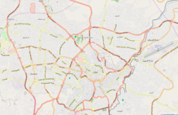
Amman witnessed rapid growth after its designation as Transjordan's capital in 1921, receiving migrations from different Jordanian and Levantine cities, and later several successive waves of refugees: Palestinians in 1948 and 1967; Iraqis in 1990 and 2003; and Syrians since 2011. It was initially built on seven hills, but now spans over 19 hills combining 22 areas,[10] which are administered by the Greater Amman Municipality.[11] Areas of Amman have gained their names from either the hills (jabal) or the valleys (wadi) they occupy, such as Jabal al-Luweibdeh and Wadi Abdoun.[10] East Amman is predominantly filled with historic sites that frequently host cultural activities, while West Amman is more modern and serves as the economic center of the city.[12]
Approximately one million visitors arrived in Amman in 2018, which made it the 89th most-visited city in the world and the 12th most-visited Arab city. Amman has a relatively fast growing economy[13] and it is ranked as a Beta− global city by the Globalization and World Cities Research Network.[14] Moreover, it was named one of the Middle East and North Africa's best cities according to economic, labor, environmental, and socio-cultural factors.[15] The city is among the most popular locations in the Arab world for multinational corporations to set up their regional offices, alongside Doha and only behind Dubai.[16] Amman has a bus network, including a Bus Rapid Transit (BRT) system that serves the city and connects it to neighboring Zarqa.
- ^ Trent Holden, Anna Metcalfe (2009). The Cities Book: A Journey Through the Best Cities in the World. Lonely Planet Publications. p. 36. ISBN 978-1-74179-887-6. Archived from the original on 18 May 2020. Retrieved 24 August 2017.
- ^ "Amman's Street Food". BeAmman.com. Archived from the original on 26 September 2015. Retrieved 26 September 2015.
- ^ "New Amman mayor pledges 'fair and responsible' governance". jodantimes.com. 21 August 2017. Archived from the original on 11 August 2018. Retrieved 23 October 2018.
- ^ "New Member: Yousef Al-Shawarbeh – Amman, Jordan". globalparliamentofmayors.org. June 2018. Archived from the original on 24 December 2018. Retrieved 29 December 2018.
- ^ Lipiński, Edward (2006). On the Skirts of Canaan in the Iron Age: Historical and Topographical Researches. Peeters Publishers. p. 295. ISBN 978-9042917989.
- ^ Parpola, Simo (1970). Neo-Assyrian Toponyms. Kevaeler: Butzon & Bercker. p. 76.
- ^ "Revealed: the 20 cities UAE residents visit most". Arabian Business Publishing Ltd. 1 May 2015. Archived from the original on 26 September 2015. Retrieved 21 September 2015.
- ^ "Population Estimates for The End of 2021" (PDF). Department of Statistics (DoS). January 2022. Archived (PDF) from the original on 28 November 2020. Retrieved 20 November 2021.
- ^ Hamed-Troyansky, Vladimir (2017). "Circassians and the Making of Amman, 1878–1914". International Journal of Middle East Studies. 49 (4): 605–623. doi:10.1017/S0020743817000617. S2CID 165801425.
- ^ a b c Michael Dumper; Bruce E. Stanley (2007). Cities of the Middle East and North Africa: A Historical Encyclopedia. ABC-CLIO. p. 35. ISBN 978-1-57607-919-5. Archived from the original on 18 May 2020. Retrieved 23 September 2015.
- ^ "Aqel Biltaji appointed as Amman mayor". The Jordan Times. 8 September 2013. Archived from the original on 30 September 2015. Retrieved 21 September 2015.
- ^ Obeidat, Omar (12 August 2014). "West Amman furnished apartments cashing in on tour". The Jordan Times. Archived from the original on 4 March 2016. Retrieved 21 September 2015.
- ^ MacBride, Elizabeth (31 December 2014). "How a Startup from the Arab World Grabs 1B Views on YouTube". Forbes. Archived from the original on 29 July 2017. Retrieved 29 September 2015.
- ^ "The World According to GaWC 2020". Globalization and World Cities – Research Network. Archived from the original on 24 August 2020. Retrieved 31 August 2020.
- ^ IANS/WAM (26 November 2010). "Abu Dhab duke City' in MENA region". sify news. Archived from the original on 30 November 2010. Retrieved 22 September 2015.
- ^ "Amman Favored by MNCs as New Regional Hub". Dunia Frontier Consultants, Doha. 25 January 2012. Archived from the original on 11 March 2013. Retrieved 28 November 2012.


