Back Condau de Tyrone AN Tirowen ANG تيرون (مقاطعة) Arabic Condáu de Tyrone AST Тайроун Bulgarian Kontelezh Tír Eoghain Breton Comtat de Tyrone Catalan Hrabství Tyrone Czech Swydd Tyrone Welsh County Tyrone Danish
County Tyrone
| |
|---|---|
| Nickname: The Red Hand County | |
| Motto(s): | |
 | |
| Country | United Kingdom |
| Region | Northern Ireland |
| Province | Ulster |
| Established | 1585 |
| County town | Omagh |
| Area | |
• Total | 1,261 sq mi (3,270 km2) |
| • Rank | 8th |
| Highest elevation | 2,224 ft (678 m) |
| Population (2021) | 188,383 |
| • Rank | 11th[2] |
| Time zone | UTC±0 (GMT) |
| • Summer (DST) | UTC+1 (BST) |
| Postcode area | |
| Contae Thír Eoghain is the Irish name; Countie Tyrone,[3] Coontie Tyrone[4] and Coontie Owenslann[5] are Ulster Scots spellings (the latter used only by Dungannon & South Tyrone Borough Council). | |
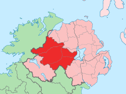
County Tyrone (/tɪˈroʊn/;[6] from Irish Tír Eoghain, meaning 'land of Eoghan' [tʲiːɾʲ ˈoːnʲ]) is one of the six counties of Northern Ireland, one of the nine counties of Ulster and one of the thirty-two traditional counties of Ireland. Its county town is Omagh.
Adjoined to the south-west shore of Lough Neagh, the county covers an area of 1,261 square miles (3,266 km2),[1] making it the largest of Northern Ireland's six counties by size, and the second largest county in Ulster after Donegal. With a population of 188,383 as of the 2021 census, Tyrone is the 5th most populous county in both Northern Ireland and Ulster, and the 11th most populous county on the island of Ireland. The county derives its name and general geographic location from Tír Eoghain, a Gaelic kingdom under the O'Neill dynasty which existed until the 17th century.
- ^ a b Northern Ireland General Register Office (1975). "Table 1: Area, Buildings for Habitation and Population, 1971". Census of Population 1971; Summary Tables (PDF). Belfast: HMSO. p. 1. Archived (PDF) from the original on 23 July 2019. Retrieved 28 August 2019.
- ^ "Religion or religion brought up in". NISRA. Retrieved 17 August 2023.
- ^ "North-South Ministerial Council: 2010 Annual Report in Ulster Scots" (PDF). Archived from the original (PDF) on 27 February 2013. Retrieved 18 January 2013.
- ^ "North-South Ministerial Council: 2006 Annual Report in Ulster Scots" (PDF). Archived from the original (PDF) on 27 February 2013. Retrieved 18 January 2013.
- ^ "Dungannon and South Tyrone Borough Council". Dungannon.gov.uk. Archived from the original on 8 April 2013. Retrieved 18 January 2013.
- ^ BBC (1990). Graham E. Pointon (ed.). BBC pronouncing dictionary of British names (2 ed.). New York: Oxford University Press. p. 248. ISBN 0192827456.
Tyrone Co. name, ti'roʊn
