| N53 road | |
|---|---|
| Bóthar N53 | |
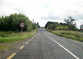
 The N53 at the Armagh / Louth border, entering the Republic | |
| Route information | |
| Length | 17.5 km (10.9 mi) |
| Location | |
| Country | Ireland |
| Primary destinations | |
| Highway system | |
The N53 road is a national secondary road in Ireland, running from Dundalk, County Louth, to Castleblayney, County Monaghan, but with a short gap where it crosses the Republic of Ireland–United Kingdom border and runs through Northern Ireland.
The road was established before the partition of Ireland and became Concession Road in Northern Ireland owing to its lack of formal custom facilities. The cross-border location of the N53 has attracted businesses taking advantage of different laws and taxes, but also created problems following Brexit, which may see border facilities established on the road for the first time.

