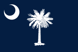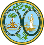
Back Suid-Carolina Afrikaans ሳውዝ ካሮላይና Amharic Carolina d'o Sud AN Suþcarolina ANG كارولاينا الجنوبية Arabic كارولينا لجنوبية ARY ساوث كارولاينا ARZ Carolina del Sur AST South Carolina suyu Aymara Cənubi Karolina Azerbaijani
South Carolina | |
|---|---|
| Nickname: The Palmetto State | |
| Motto(s): | |
| Anthem: "Carolina" "South Carolina on my Mind" | |
 Map of the United States with South Carolina highlighted | |
| Country | United States |
| Before statehood | Province of South Carolina |
| Admitted to the Union | May 23, 1788 (8th state) |
| Capital | Columbia |
| Largest city | Charleston |
| Largest county or equivalent | Greenville |
| Largest metro and urban areas | Greenville (combined and metro) Columbia (urban) |
| Government | |
| • Governor | Henry McMaster (R) |
| • Lieutenant governor | Pamela Evette (R) |
| Legislature | General Assembly |
| • Upper house | Senate |
| • Lower house | House of Representatives |
| Judiciary | South Carolina Supreme Court |
| U.S. senators | Lindsey Graham (R) Tim Scott (R) |
| U.S. House delegation | 6 Republicans 1 Democrat (list) |
| Area | |
• Total | 32,020.49 sq mi (82,932.7 km2) |
| • Land | 30,060.70 sq mi (77,856.9 km2) |
| • Water | 1,959.79 sq mi (5,075.8 km2) 6.12% |
| • Rank | 40th |
| Dimensions | |
| • Length | 260 mi (420 km) |
| • Width | 200 mi (320 km) |
| Elevation | 350 ft (110 m) |
| Highest elevation | 3,560 ft (1,085 m) |
| Lowest elevation (Atlantic Ocean[1]) | 0 ft (0 m) |
| Population (2020) | |
• Total | 5,118,425[2] |
| • Rank | 23rd |
| • Density | 170.27/sq mi (65.74/km2) |
| • Rank | 19th |
| • Median household income | $50,570[3] |
| • Income rank | 41st |
| Demonyms | South Carolinian |
| Language | |
| • Official language | English |
| • Spoken language | |
| Time zone | UTC−05:00 (Eastern) |
| • Summer (DST) | UTC−04:00 (EDT) |
| USPS abbreviation | SC |
| ISO 3166 code | US-SC |
| Traditional abbreviation | S.C. |
| Latitude | 32°02′ N to 35°13′ N |
| Longitude | 78°32′ W to 83°21′ W |
| Website | sc |
| List of state symbols | |
|---|---|
 | |
 | |
| Living insignia | |
| Amphibian | Spotted Salamander |
| Bird | Carolina Wren |
| Butterfly | Eastern Tiger Swallowtail |
| Dog breed | Boykin Spaniel |
| Fish | Striped bass |
| Flower | Yellow jessamine |
| Insect | Carolina mantis |
| Mammal | White-tailed deer |
| Reptile | Loggerhead sea turtle |
| Tree | Sabal palmetto |
| Inanimate insignia | |
| Beverage | Milk |
| Dance | Carolina shag |
| Food |
|
| Fossil | Columbian mammoth (Mammuthus columbi) |
| Mineral | Amethyst |
| Rock | Blue Granite |
| Shell | Lettered olive |
| Other | Hogna carolinensis |
| State route marker | |
 | |
| State quarter | |
 Released in 2000 | |
| Lists of United States state symbols | |
South Carolina (/ˌkærəˈlaɪnə/ ⓘ KARR-ə-LY-nə) is a state in the Southeastern region of the United States. It borders North Carolina to the north and northeast, the Atlantic Ocean to the southeast, and Georgia to the west and south across the Savannah River. Along with North Carolina, it makes up the Carolinas region of the East Coast. South Carolina is the 40th-largest and 23rd-most populous U.S. state with a recorded population of 5,118,425 according to the 2020 census.[2] In 2019[update], its GDP was $213.45 billion. South Carolina is composed of 46 counties. The capital is Columbia with a population of 136,632 in 2020;[5] while its most populous city is Charleston with a 2020 population of 150,227.[6] The Greenville-Spartanburg-Anderson, SC Combined Statistical Area is the most populous combined metropolitan area in the state, with an estimated 2023 population of 1,590,636.[7]
South Carolina derives its name from King Charles I of England, who was instrumental in establishing the English colony, with Carolus being the Latin equivalent of "Charles".[8] The Province of South Carolina was officially created in 1712. As one of the original Thirteen Colonies, it transitioned to a royal colony in 1719. Throughout the American Revolutionary War, South Carolina witnessed significant military engagement, hosting over 200 battles and skirmishes.[9] On May 23, 1788, South Carolina became the eighth state to ratify the U.S. Constitution. As a slave state, it was the first to vote for secession from the Union on December 20, 1860. Following the American Civil War, South Carolina was readmitted to the Union on July 9, 1868.
In the early to mid-20th century, South Carolina experienced significant economic development with the establishment of numerous textile mills and factories throughout the state. The civil rights movement during the mid-20th century played a crucial role in dismantling segregation and discriminatory laws in the state. Following World War II, South Carolina's economic diversification accelerated, leading to a broader range of industries. By the early 21st century, the state's economy had evolved to include sectors such as aerospace, agribusiness, automotive manufacturing, and tourism.[10]
South Carolina features three primary geographic regions stretching from east to west: the Atlantic coastal plain, the Piedmont, and the Blue Ridge Mountains located in the northwestern part of Upstate South Carolina. The state predominantly experiences a humid subtropical climate characterized by hot, humid summers and mild winters. In the Upstate region, the climate shifts to a subtropical highland type. The eastern coastal plain is dotted with numerous salt marshes and estuaries. The southeastern Lowcountry of South Carolina includes parts of the Sea Islands, a series of barrier islands along the Atlantic Ocean.
- ^ a b "Elevations and Distances in the United States". United States Geological Survey. 2001. Archived from the original on October 15, 2011. Retrieved October 24, 2011.
- ^ a b Cite error: The named reference
2020CensusQuickFactswas invoked but never defined (see the help page). - ^ "Median Annual Household Income". The Henry J. Kaiser Family Foundation. Archived from the original on December 20, 2016. Retrieved December 9, 2016.
- ^ https://ed.sc.gov/districts-schools/health-and-nutrition/meal-programs/civil-rights-limited-english-proficiency-accessibility-requirements/facts-top-10-languages-of-south-carolina-other-than-english/
- ^ "QuickFacts: Columbia city, South Carolina". Archived from the original on June 11, 2019. Retrieved March 23, 2024.
- ^ "QuickFacts: Charleston city, South Carolina". Archived from the original on March 31, 2019. Retrieved March 23, 2024.
- ^ Cite error: The named reference
PopEstCBSAwas invoked but never defined (see the help page). - ^ N. C. Board of Agriculture (1902). A sketch of North Carolina. Charleston: Lucas-Richardson Co. p. 4. OL 6918901M.
- ^ Revolutionary War in South Carolina. Discover South Carolina. Retrieved July 15, 2022.
- ^ 2019 Top Industries in South Carolina Archived June 15, 2021, at the Wayback Machine. greerdevelopment.com. Retrieved June 14, 2021.
Cite error: There are <ref group=lower-alpha> tags or {{efn}} templates on this page, but the references will not show without a {{reflist|group=lower-alpha}} template or {{notelist}} template (see the help page).

