Back مقاطعة سانت لويس (مينيسوتا) Arabic St. Louis County, Minnesota BAR Сейнт Луис (окръг, Минесота) Bulgarian সেন্ট লুইস কাউন্টি, মিনেসোটা BPY Séng Louis Gông (Minnesota) CDO Сент-Луис (гуо, Миннесота) CE Saint Louis County (kondado sa Tinipong Bansa, Minnesota) CEB St. Louis County, Minnesota Welsh St. Louis County (Minnesota) Danish St. Louis County (Minnesota) German
St. Louis County | |
|---|---|
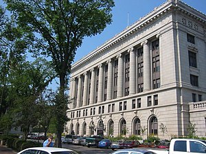
 St. Louis County Courthouse in Duluth | |
 Location within the U.S. state of Minnesota | |
 Minnesota's location within the U.S. | |
| Coordinates: 47°35′N 92°28′W / 47.58°N 92.46°W | |
| Country | |
| State | |
| Founded | February 20, 1855[1] |
| Named for | St. Louis River[2] |
| Seat | Duluth |
| Largest city | Duluth |
| Area | |
| • Total | 6,860 sq mi (17,800 km2) |
| • Land | 6,247 sq mi (16,180 km2) |
| • Water | 612 sq mi (1,590 km2) 8.9% |
| Population (2020) | |
| • Total | 200,231 |
| • Estimate (2023) | 200,514 |
| • Density | 29/sq mi (11/km2) |
| Time zone | UTC−6 (Central) |
| • Summer (DST) | UTC−5 (CDT) |
| Congressional district | 8th |
| Website | www |
St. Louis County is a county located in the Arrowhead Region of the U.S. state of Minnesota. As of the 2020 census, the population was 200,231.[3] Its county seat is Duluth. It is the largest county in Minnesota by land area, and the largest in the United States by total area east of the Mississippi River. St. Louis County is included in the Duluth, MN–Superior, WI Metropolitan Statistical Area.
Major industries include pulpwood production and tourism. Open pit mining of taconite and processing it into high grade iron ore remains an important part of the economy of the Iron Range and is directly tied to shipping in the twin ports of Duluth and Superior. Parts of the federally recognized Bois Forte and Fond du Lac Indian reservations are in the county.
- ^ "Minnesota Place Names". Minnesota Historical Society. Archived from the original on June 20, 2012. Retrieved March 19, 2014.
- ^ Chicago and North Western Railway Company (1908). A History of the Origin of the Place Names Connected with the Chicago & North Western and Chicago, St. Paul, Minneapolis & Omaha Railways. p. 164.
- ^ "State & County QuickFacts". United States Census Bureau. Retrieved April 8, 2023.