Back Yalu Afrikaans يالو (نهر) Arabic یالو چایی AZB Ялуцзян Byelorussian Ялудзян Bulgarian Yalou Breton Riu Yalu Catalan Yalu River CEB ڕووباری یالو CKB Jalu Czech
| Yalu Amnok | |
|---|---|
 | |
 Location of the Yalu River | |
| Etymology | See #Name |
| Native name | |
| Location | |
| Countries | China (PRC) and North Korea (DPRK) |
| Provinces | Jilin (PRC), Liaoning (PRC), Ryanggang (DPRK), Chagang (DPRK), North Pyongan (DPRK), Sinuiju SAR (DPRK) |
| Physical characteristics | |
| Source | South of Heaven Lake, PRC-DPRK border, Paektu Mountain |
| • coordinates | 41°58′8″N 128°4′24″E / 41.96889°N 128.07333°E |
| Mouth | Korea Bay |
• coordinates | 39°52′N 124°19′E / 39.867°N 124.317°E |
| Length | 790 km (490 mi) |
 | |
| Yalu River | |||||||||||||||||||||
|---|---|---|---|---|---|---|---|---|---|---|---|---|---|---|---|---|---|---|---|---|---|
| Chinese name | |||||||||||||||||||||
| Traditional Chinese | 鴨綠江 | ||||||||||||||||||||
| Simplified Chinese | 鸭绿江 | ||||||||||||||||||||
| |||||||||||||||||||||
| Korean name | |||||||||||||||||||||
| Chosŏn'gŭl | 압록강 | ||||||||||||||||||||
| Hancha | 鴨綠江 | ||||||||||||||||||||
| |||||||||||||||||||||
| Manchu name | |||||||||||||||||||||
| Manchu script | ᠶᠠᠯᡠ ᡠᠯᠠ | ||||||||||||||||||||
| Romanization | Yalu ula | ||||||||||||||||||||
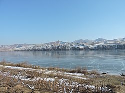
The Yalu River (Chinese: 鸭绿江; pinyin: Yālù Jiāng) or Amnok River (Korean: 압록강; MR: Amnokkang) is a river on the border between China and North Korea. Together with the Tumen River to its east, and a small portion of Paektu Mountain, the Yalu forms the border between China and North Korea. Its valley has been the scene of several military conflicts in the past centuries. It borders North Korea to the south and China to the north.