Bodin Municipality
Bodin herred Bodø landdistrikt (historic) | |
|---|---|
 | |
 Nordland within Norway | |
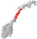
 Bodin within Nordland | |
| Coordinates: 67°16′26″N 14°26′05″E / 67.27389°N 14.43472°E | |
| Country | Norway |
| County | Nordland |
| District | Salten |
| Established | 1 Jan 1838 |
| • Created as | Formannskapsdistrikt |
| Disestablished | 1 Jan 1968 |
| • Succeeded by | Bodø Municipality |
| Area (upon dissolution) | |
| • Total | 672 km2 (259 sq mi) |
| Population (1968) | |
| • Total | 14,252 |
| • Density | 21/km2 (55/sq mi) |
| Time zone | UTC+01:00 (CET) |
| • Summer (DST) | UTC+02:00 (CEST) |
| ISO 3166 code | NO-1843[1] |
Bodin is a parish and former municipality in Nordland county, Norway. The 672-square-kilometre (259 sq mi) municipality existed from 1838 until its dissolution in 1968. It was a large municipality encompassing all of the mainland area around the town of Bodø and part of the land on the southern shore of the Saltfjorden. The municipality also included over 100 square kilometres (39 sq mi) of islands, notably the islands of Helligvær, Landegode, Bliksvær, and Givær plus numerous others. In all there were over 700 islands, islets, and skerries in Bodin Municipality. All of what was Bodin Municipality now lies entirely inside the present-day Bodø Municipality.[2][3]
The present-day parish of Bodin represents the mainland area immediately surrounding the town of Bodø and the western islands. The main church for the parish is the historic Bodin Church.
- ^ Bolstad, Erik; Thorsnæs, Geir, eds. (2023-01-26). "Kommunenummer". Store norske leksikon (in Norwegian). Kunnskapsforlaget.
- ^ Thorsnæs, Geir, ed. (2016-05-30). "Bodin". Store norske leksikon (in Norwegian). Kunnskapsforlaget. Retrieved 2018-09-16.
- ^ Helland, Amund (1908). "Bodin herred". Norges land og folk: Nordlands amt (in Norwegian). Vol. XVIII. Kristiania, Norway: H. Aschehoug & Company. p. 79. Retrieved 2018-09-16.
