Budal Municipality
Budal herred | |
|---|---|
| Budalen herred (historic name) | |
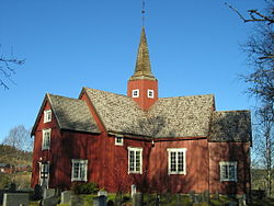
 View of the local church | |
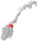
 Sør-Trøndelag within Norway | |
 Budal within Sør-Trøndelag | |
| Coordinates: 62°53′06″N 10°29′01″E / 62.88500°N 10.48361°E | |
| Country | Norway |
| County | Sør-Trøndelag |
| District | Gauldalen |
| Established | 1879 |
| • Preceded by | Støren Municipality |
| Disestablished | 1 Jan 1964 |
| • Succeeded by | Midtre Gauldal Municipality |
| Administrative centre | Enodden |
| Area (upon dissolution) | |
| • Total | 350 km2 (140 sq mi) |
| Population (1964) | |
| • Total | 529 |
| • Density | 1.5/km2 (3.9/sq mi) |
| Demonyms | Budaling Budøl[1] |
| Time zone | UTC+01:00 (CET) |
| • Summer (DST) | UTC+02:00 (CEST) |
| ISO 3166 code | NO-1647[2] |
Budal is a former municipality in the old Sør-Trøndelag county, Norway. The 350-square-kilometre (140 sq mi) municipality[3] existed from 1879 until its dissolution in 1964. It encompassed the Bua and Ena river valleys in the south-central part of the what is now Midtre Gauldal municipality in Trøndelag county. The administrative center of Budal was the village of Enodden where Budal Church is located.[4]
- ^ "Navn på steder og personer: Innbyggjarnamn" (in Norwegian). Språkrådet.
- ^ Bolstad, Erik; Thorsnæs, Geir, eds. (26 January 2023). "Kommunenummer". Store norske leksikon (in Norwegian). Kunnskapsforlaget.
- ^ Helland, Amund (1898). "Budalens herred". XVI Søndre Trondheims amt. Anden del. Norges land og folk (in Norwegian). Kristiania, Norway: H. Aschehoug & Company. p. 282. Retrieved 3 July 2022.
- ^ Haugen, Morten, ed. (29 August 2017). "Budal – tidligere kommune". Store norske leksikon (in Norwegian). Kunnskapsforlaget. Retrieved 17 January 2018.
