Back نهر چونياتا ARZ Juniata River German Juniata (rivière) French 주니아타강 Korean Juniata River Polish Juniata River Swedish 朱尼亚塔河 Chinese
| Juniata River | |
|---|---|
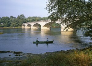 The Appalachian Trail crossing the mouth of the Juniata River. Photo by Carol M. Highsmith | |
 Juniata River watershed and tributaries | |
| Location | |
| Country | United States |
| State | Pennsylvania |
| Counties | Dauphin, Perry, Juniata, Mifflin, Huntingdon, Bedford, Somerset |
| Cities | Duncannon, Newport, Millerstown, Thompsontown, Port Royal, Mifflintown, Lewistown, Mount Union, Huntingdon |
| Physical characteristics | |
| Source | Frankstown Branch |
| • location | Blair County, Pennsylvania, US |
| 2nd source | Little Juniata River |
| • location | Pennsylvania, US |
| Source confluence | |
| • location | Petersburg, Pennsylvania, US |
| • coordinates | 40°33′39″N 78°04′06″W / 40.56083°N 78.06833°W |
| • elevation | 660 ft (200 m) |
| Mouth | Susquehanna River |
• location | Duncannon, Perry County, Dauphin County, Pennsylvania, US |
• coordinates | 40°24′05″N 77°00′48″W / 40.40139°N 77.01333°W |
• elevation | 330 ft (100 m) |
| Length | 104 mi (167 km) |
| Basin size | 3,400 sq mi (8,800 km2) |
| Discharge | |
| • location | Newport |
| • average | 4,476 cu ft/s (126.7 m3/s) |
| • minimum | 636 cu ft/s (18.0 m3/s) |
| • maximum | 209,000 cu ft/s (5,900 m3/s) |
| Discharge | |
| • location | Mapleton Depot |
| • average | 2,724 cu ft/s (77.1 m3/s) |
| Basin features | |
| Tributaries | |
| • left | Standing Stone Creek, Kishacoquillas Creek |
| • right | Raystown Branch, Aughwick Creek, Tuscarora Creek |
The Juniata River (/ˈdʒuːniˌɑːtə/) (pronounced joo-nee-ah-tah[1]) is a tributary of the Susquehanna River, approximately 104 miles (167 km) long,[2] in central Pennsylvania. The river is considered scenic along much of its route, having a broad and shallow course passing through several mountain ridges and steeply lined water gaps. It formed an early 18th-century frontier region in Pennsylvania and was the site of French-allied Native American attacks against English colonial settlements during the French and Indian War.
The watershed of the river encompasses an area of approximately 3,400 square miles (8,800 km2), approximately one-eighth of the drainage area of the Susquehanna. Approximately two-thirds of the watershed is forested. It is the second largest tributary of the Susquehanna after the West Branch Susquehanna.
- ^ "Juniata College - All Together Now: JOO-NEE-AT-UH!". Retrieved 2023-12-23.
- ^ U.S. Geological Survey. National Hydrography Dataset high-resolution flowline data. The National Map Archived 2012-03-29 at the Wayback Machine, accessed August 8, 2011