Back Chiu-lung Wan CEB Kowloon Bay German Baia di Kowloon Italian 九龍湾 Japanese 가우룽완 Korean Chiu-lung Wan Swedish 九龍灣 Chinese 九龍灣 ZH-YUE
This article has multiple issues. Please help improve it or discuss these issues on the talk page. (Learn how and when to remove these template messages)
|
| Kowloon Bay | |||||||||||||
|---|---|---|---|---|---|---|---|---|---|---|---|---|---|
| Traditional Chinese | 九龍灣 | ||||||||||||
| Simplified Chinese | 九龙湾 | ||||||||||||
| Jyutping | Gau2 lung4 waan1 | ||||||||||||
| Cantonese Yale | Gáu lùhng wāan | ||||||||||||
| Hanyu Pinyin | Jiǔlóng Wān | ||||||||||||
| Literal meaning | bay of the 9 dragons | ||||||||||||
| |||||||||||||


Kowloon Bay is a bay within Victoria Harbour and an neighbourhood within Kowloon, Hong Kong.
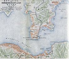
The bay is located at the east of the Kowloon Peninsula and north of Hong Kong Island. It is the eastern portion of Victoria Harbour, between Hung Hom and Lei Yue Mun. The bay was divided into half when the 13/31 runway of the former Kai Tak International Airport was constructed in the middle of the bay in the mid-1950s.
The reclamation of north-eastern Kowloon Bay near Ngau Tau Kok is also named Kowloon Bay. It was formerly known as Ngau Tau Kok Industrial Area. After the construction of MTR Kowloon Bay station, the area is referred to as Kowloon Bay. The area near the MTR station is residential while the area near the shore is industrial. The area is traditionally an extension of Ngau Tau Kok, and thus facilities such as Ngau Tau Kok Police Station are located there.