Back কুমাঊঁ বিভাগ Assamese Кумаон Byelorussian কুমায়ূন বিভাগ Bengali/Bangla Kumaon Catalan Kumáón Czech Kumaon Basque Division de Kumaon French कुमाऊँ मण्डल Hindi Divisione del Kumaon Italian クマーウーン Japanese
Kumaon
Kurmanchal Manaskhand | |
|---|---|
Clockwise from top: View of Panchachuli peaks from Munsiyari, Jim Corbett National Park, Ranikhet, Kali river at Jauljibi,
View of Purnagiri hills from Tanakpur, Johar Valley, Naini Lake, Jageshwar | |
| Nickname: The Home of Gods[1] | |
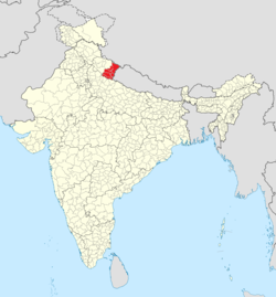
 Location in India | |
| Country | |
| Established | 1815[2] |
| Headquarter | Nainital |
| Largest city | Haldwani |
| Districts | |
| Government | |
| • Type | Division |
| • Commissioner | Deepak Rawat IAS[3] |
| • Legislature |
|
| Area | |
| • Total | 21,035 km2 (8,122 sq mi) |
| Population | |
| • Total | 4,228,998[4] |
| • Density | 201.04/km2 (520.7/sq mi) |
| Demonym(s) | Kumaonis, Kumaiye |
| Ethnicity and Language | |
| • Languages | Native: Kumaoni, Tharu(Buksari), RungLo Official: Hindi |
| • Ethnic groups | Kumaonis, Shaukas, Rungs, Bhotiyas, Tharus(Bhoksa) |
| Time zone | UTC+5:30 (IST) |
| Vehicle registration | UK |
| Highest peak of Kumaon Division | Hardeol 7,151 m (23,461 ft) |
| Lowest elevation of Kumaon Division | Sharda Sagar Reservoir (190 m)[5] |
| Largest lake | Bhimtal |
| Website | http://kumaon.gov.in/ |
Kumaon (/ˈkɛmɔːʊ/; Kumaoni: Kumāū; pronounced [kuːmɔːʊ]; historically romanised as Kemāon[6][7]) is a revenue and administrative division in the Indian State of Uttarakhand. It spans over the eastern half of the state and is bounded on the north by Tibet, on the east by Nepal, on the south by the state of Uttar Pradesh, and on the west by Garhwal. Kumaon comprises six districts of the state: Almora, Bageshwar, Champawat, Nainital, Pithoragarh and Udham Singh Nagar.
Historically known as Manaskhand and then Kurmanchal, the Kumaon region has been ruled by several Hindu dynasties over the course of history; most notably the Katyuris and the Chands. The Kumaon division was established in 1816, when the British reclaimed this region from the Gorkhas, who had annexed the erstwhile Kingdom of Kumaon in 1790. It was formed into a division of what was then called Ceded and Conquered Provinces, later known as United Provinces. In independent India the state was called Uttar Pradesh. In 2000, the new state of Uttarakhand was carved out of Uttar Pradesh, including Kumaon.
The people of Kumaon are known as Kumaonis and speak the Kumaoni language. Kumaon is home to a famous Indian Army regiment, the Kumaon Regiment. The hill town Nainital is its administrative centre and this is where the Uttarakhand high court is located.[8] Other notable hill towns of Kumaon are Almora, Ranikhet, Pithoragarh, Champawat and Bageshwar. However, all the major cities of the region like Ramnagar, Haldwani, Rudrapur and Kashipur,Tanakpur are concentrated in the southern plain areas of Bhabar and Terai.
- ^ "Kumaon - Home of the Gods from Nest & Wings - Kumaon Complete Travel Guide".
- ^ Robert Montgomery Martin, History of the Possessions of the Honourable East India Company, Volume 1, pg. 107
- ^ ""Divisional Commissioner details: Office of Commissioner Kumaon"".
- ^ Cite error: The named reference
census2011-C16was invoked but never defined (see the help page). - ^ "Ichthyofaunal Diversity of Sharda Sagar Reservoir in Tarai Region" (PDF). Open Academics Journal Index. Retrieved 9 September 2019.
- ^ James Prinsep (Editor)Journal of the Asiatic Society of Bengal, Volume 6, Part 2 (1837), p. 653, at Google Books
- ^ John McClelland Some inquiries in the province of Kemaon: relative to geology, and other branches of Natural Science (1835) at Google Books
- ^ Iwanek, Krzysztof (17 March 2020). "Gairsain's Uphill Task: Uttarakhand's Plan for Two Capitals". The Diplomat. Retrieved 16 May 2022.


