Back خليج ماليان Arabic Малиакски залив Bulgarian Pleg-mor Maliak Breton Golf Malíac Catalan Maliakós Kólpos CEB Maliabugten Danish Golf von Malia German Μαλιακός κόλπος Greek Golfo Maliaco Spanish Maliakóslahti Finnish


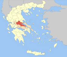
The Malian or Maliac Gulf (Greek: Μαλιακός Κόλπος, romanized: Maliakós Kólpos) is a gulf in the western Aegean Sea. It forms part of the coastline of Greece's region of Phthiotis. The gulf stretches east to west to a distance of 15 to 22 kilometers (9.3 to 13.7 mi), depending on the definition, and is very shallow, with a maximum depth of 27 meters (89 ft). The only harbour is that of Stylida, which serves the city of Lamia. To its east is Cape Lichada, the northwesternmost point of the island of Euboea.