Back منطقة ماو Arabic ماو ARZ मऊ जिला Bihari মউ জেলা Bengali/Bangla Mau (distrito) CEB Mau (distrikt) Danish Mau (Distrikt) German Distrito de Mau Spanish Mau barrutia Basque بخش مائو Persian
Mau district | |
|---|---|
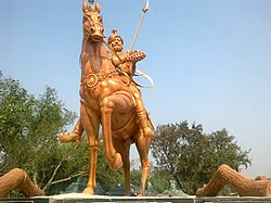
 Statue of Thakur Barisan Dev in Mau | |
 Location of Mau district in Uttar Pradesh | |
| Country | |
| State | Uttar Pradesh |
| Division | Azamgarh |
| Headquarters | Mau |
| Tehsils | Mau Ghosi |
| Government | |
| • Lok Sabha constituencies | Ghosi |
| • Vidhan Sabha constituencies | Ghosi , Madhuban, Maunath Bhanjan (Sadar), Muhammadabad-Gohna Assembly constituency |
| Area | |
| • Total | 1,713 km2 (661 sq mi) |
| Population (2011) | |
| • Total | 2,205,968 |
| • Density | 1,300/km2 (3,300/sq mi) |
| Demographics | |
| • Literacy | 80.16 per cent |
| • Sex ratio | 978 |
| Time zone | UTC+05:30 (IST) |
| Major highways | NH-24 |
| Website | mau |
Mau district is one of the districts of Uttar Pradesh state of India, and Mau town is the district headquarters which is also one of the few remaining areas of handloom saree production in eastern Uttar Pradesh, specializing in Sadiya silk sarees.[1] Mau was carved out as a separate district from Azamgarh on 19 November 1988. It is situated in the south-eastern part of the state with headquarters in Maunath Bhanjan. The district is surrounded by Ghazipur district on the south, Ballia district in the east, Azamgarh district in the west, and by Gorakhpur and Deoria districts on the north; says, Pallavi mishra.