Back مقاطعة سانيلاك (ميشيغان) Arabic Sanilac County, Michigan BAR Санилак (окръг, Мичиган) Bulgarian সানিলাক কাউন্টি, মিশিগান BPY Sanilac Gông (Michigan) CDO Sanilac County CEB Sanilac County, Michigan Welsh Sanilac County German Kantono Sanilac Esperanto Condado de Sanilac Spanish
Sanilac County | |
|---|---|
 | |
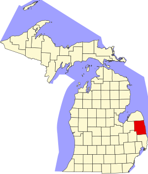
 Location within the U.S. state of Michigan | |
 Michigan's location within the U.S. | |
| Coordinates: 43°28′N 82°38′W / 43.46°N 82.64°W | |
| Country | |
| State | |
| Founded | September 10, 1822 (created) December 31, 1849 (organized)[1] |
| Seat | Sandusky |
| Largest city | Sandusky |
| Area | |
| • Total | 1,590 sq mi (4,100 km2) |
| • Land | 963 sq mi (2,490 km2) |
| • Water | 627 sq mi (1,620 km2) 39% |
| Population (2020) | |
| • Total | 40,611 |
| • Density | 26/sq mi (10/km2) |
| Time zone | UTC−5 (Eastern) |
| • Summer (DST) | UTC−4 (EDT) |
| Congressional district | 9th |
| Website | sanilaccounty |
Sanilac County (/sænəlæk/ SAN-ə-lack) is a county located in the Thumb region of the U.S. state of Michigan. As of the 2020 Census, the population was 40,611.[2] The county seat is Sandusky.[3] The county was created on September 10, 1822, and was fully organized on December 31, 1849.[1] Sanilac County is considered to be part of the Thumb of Michigan, a subregion of the Flint/Tri-Cities. Sanilac County enjoys seasonal tourism in towns such as Lexington, Port Sanilac, and Carsonville. Sanilac County is economically attached to St. Clair County and Huron County and is largely composed of nearly flat areas of rich soil.
- ^ a b Long Sanilac County
- ^ "State & County QuickFacts". US Census Bureau. Retrieved September 15, 2021.
- ^ "Find a County". National Association of Counties. Retrieved June 7, 2011.
